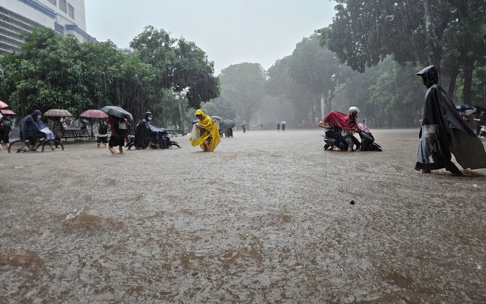
Residents travel by boat through floodwaters in western Hanoi following heavy flooding caused by storm Bualoi, October 2025. Photo: Pham Tuan / Tuoi Tre
Chairman of the Hanoi People's Committee Tran Sy Thanh signed an urgent directive on Saturday instructing departments and wards and communes to prepare for severe weather impacts.
Matmo is the 11th storm to enter the East Vietnam Sea this year.
The storm is forecast to bring heavy rainfall to Hanoi, where river levels remain high and several hydropower dams are already discharging water following recent stormy conditions.
Authorities warned of flooding risks, particularly along the Tich and Bui Rivers.
Several irrigation reservoirs have exceeded spill thresholds, while waterlogged hillsides across the region pose a high risk of landslides, the directive said.
Over 2,000 homes remain flooded or damaged from earlier storms and heavy rains.
The city's education department was told to review safety plans and allow students to stay home if needed.
Officials were also advised to enable remote work for public employees and businesses where possible.
Thanh warned of overlapping risks from multiple weather events, including flash floods and landslides, and called for "timely, decisive" local responses to protect lives and property.
Local leaders were told to prepare evacuation plans, monitor weather alerts, and reinforce critical infrastructure.
Residents in low-lying and landslide-prone areas may be relocated, especially in riverside and mountainous zones.
Hanoi's construction and agriculture departments were instructed to coordinate drainage and flood prevention efforts, lower water levels in reservoirs, and maintain critical services.
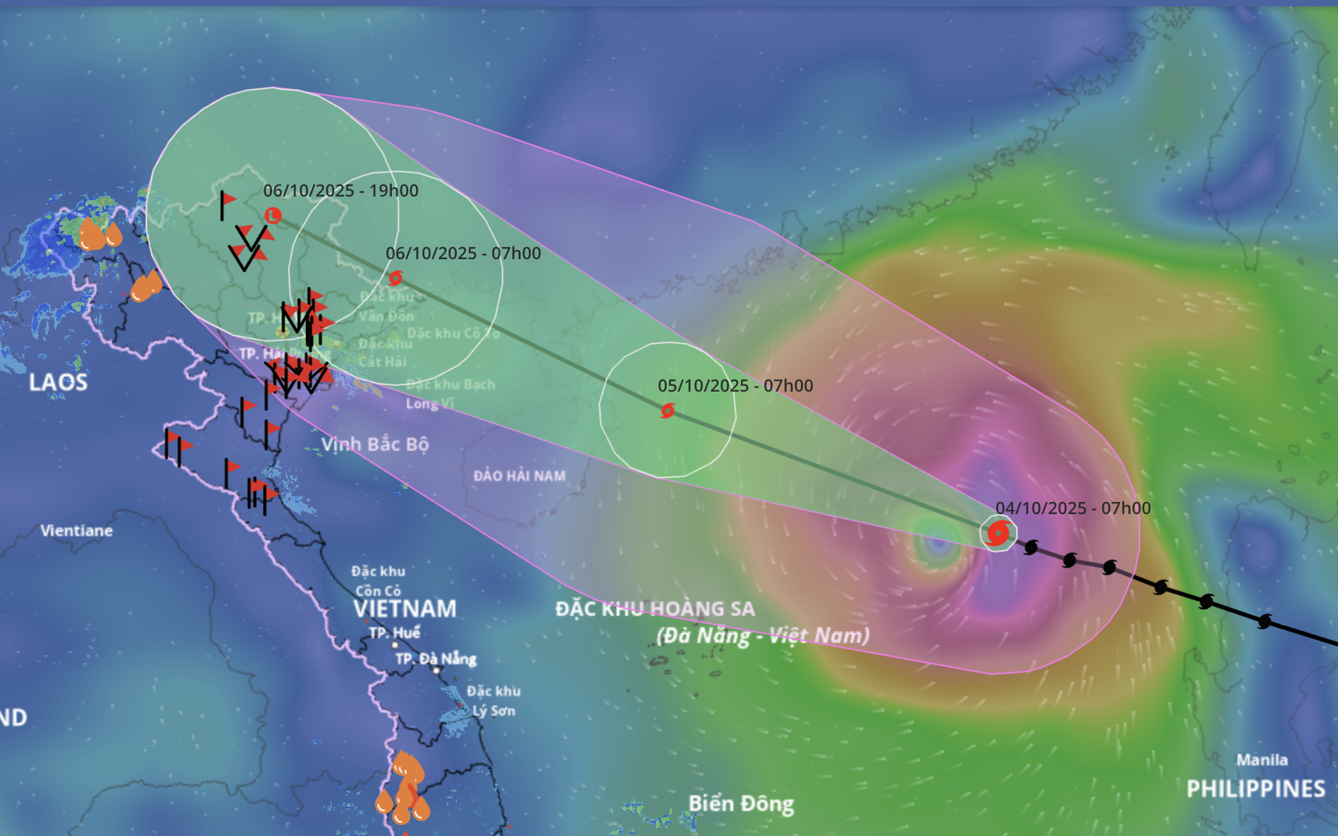
As of 8:00 am Sunday, storm Matmo was located about 400 km east-southeast of Mong Cai in Vietnam's Quang Ninh Province, with maximum sustained winds of 118–149 kph and gusts up to 167 kph, according to the National Center for Hydro-Meteorological Forecasting.
By 7:00 pm, the storm will be over the eastern part of the northern Gulf of Tonkin, around 190 km east-southeast of Quang Ninh, with sustained winds of 118–134 kph and gusts reaching 167 kph.
The storm is forecast to move west-northwest overnight and make landfall between Vietnam's Quang Ninh Province and China's Guangxi region early Monday, the center said.
At 7:00 am Monday, the center of the storm is expected to be near the Vietnam–China border, with winds decreasing to 75–88 kph and gusts of up to 118 kph.
Matmo is forecast to weaken into a tropical depression as it moves inland and dissipates over the northern mountains of Vietnam.
Heavy rainfall is expected across northern Vietnam from Sunday night through Tuesday night, with the northern mountainous and midland regions forecast to receive 150–250 mm of rain, and some areas exceeding 400 mm.
The Red River Delta, including Hanoi, and Thanh Hoa Province are expected to see moderate to heavy rain, with widespread totals of 70–150 mm and localized areas receiving over 200 mm.


Max: 1500 characters
There are no comments yet. Be the first to comment.