


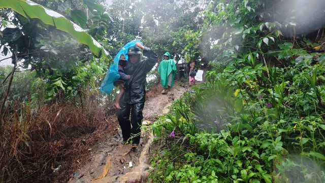
Authorities in Ngoc Linh Commune, Quang Ngai Province deployed personnel to evacuate 32 households from areas at high risk of landslides to safer locations. Photo: Supplied
Da Nang homes flooded, mountain roads cut off
In mountainous Da Nang, two days of heavy rain caused the Truong River to overflow, flooding around 20 homes in Tra My Commune by Wednesday morning.
Water rose more than one meter inside many houses, according to local authorities.
Meanwhile, landslides and flooding blocked major roads, including National Highway 40B connecting mountainous communities in the former Nam Tra My District and National Highway 24C toward Quang Ngai.
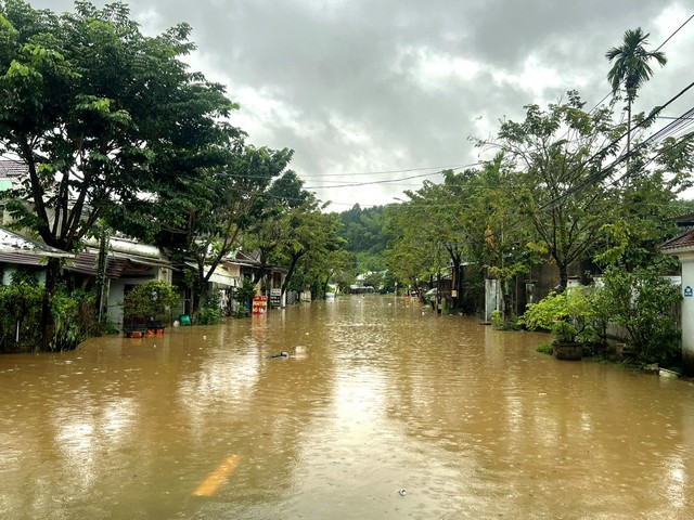
The center of Tra My Commune in Da Nang City was severely flooded on the morning of November 11, 2026. Photo: Supplied
Several roads in Tra Leng, Tra Tan, and Tra Giap Communes were also cut off.
Heavy rainfall sent large volumes of water into upstream hydropower reservoirs.
At 7:00 am, inflows into the Dak Mi 4 reservoir exceeded 1,948 cubic meters per second, lifting its water level by around 12 meters from the previous day.
At the Song Tranh 2 reservoir, inflows surged from 1,556.59 cubic meters per second at 1:00 am to 4,395.44 cubic meters per second at 7:00 am.
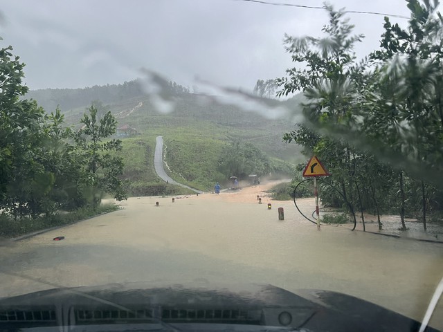
National Highway 24C, leading toward Quang Ngai Province, was cut off by flooding. Photo: Supplied
Quang Ngai evacuates residents as rivers swell
Quang Ngai Province recorded exceptionally heavy rainfall over the past 24 hours, with 545.2mm in Tra Thanh, 487mm in Son Long, and more than 400mm in several other mountainous areas, according to the provincial weather agency.
Further rainfall of 70-120mm was forecast for eastern Quang Ngai on Wednesday, with some areas expected to receive over 180mm.
Rising river levels have heightened concerns over flooding, flash floods, and landslides.
Authorities have evacuated hundreds of residents from landslide-prone communities, including nearly 60 people in Ba Vi Commune, 40 in Ba Xa, and 100 in Ngoc Linh.
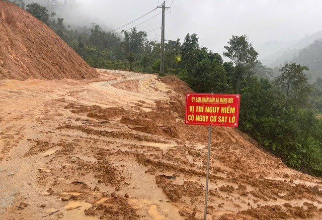
Authorities in several localities across Quang Ngai Province have inspected landslide-prone areas, installed warning signs, and deployed personnel to block access to high-risk locations. Photo: N.L.
The evacuations in Ba Xa followed the discovery of a large crack on a mountainside.
Floodwaters also submerged several roads and low-water crossings, including the Thach Nham crossing and Provincial Road 676 through Mang But Commune.
Rough seas, with waves reaching 2-3 meters, prompted authorities to temporarily suspend ferry services between Ly Son Island and Sa Ky Port.
Gia Lai blocks flooded crossings, warns of rising rivers
In eastern Gia Lai, formerly Binh Dinh Province, heavy rain overnight brought 100-120mm of rainfall to several localities, including Van Canh, An Vinh, Hoai Nhon Bac, and Quy Nhon Tay.
Rising water on the Ha Thanh River submerged several low-water crossings in Quy Nhon Dong Ward.
Police blocked access to a flooded crossing on Dien Bien Phu Street early Wednesday to prevent accidents.
In Tuy Phuoc Commune, authorities also cordoned off two temporary bridges and inspected flood-prone areas.
The provincial Department of Agriculture and Environment warned that the Ha Thanh River could reach or exceed the second-level flood warning threshold.
Low-lying areas in Quy Nhon Bac, Quy Nhon Dong, and Tuy Phuoc face heightened flooding risks if heavy rainfall coincides with high tides, which could restrict drainage into Thi Nai Lagoon.
The Lai Giang River basin is also at risk.
Authorities across the affected provinces are monitoring river levels, restricting access to dangerous roads, and preparing further evacuations if necessary.
Heavy rainfall across the region is expected to gradually ease from Thursday.


Max: 1500 characters
There are no comments yet. Be the first to comment.