
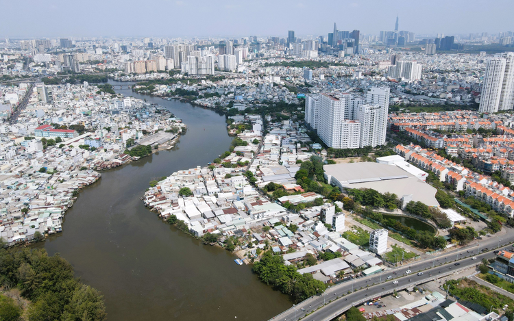
Ho Chi Minh City will mark over 515 kilometers of riverbanks for public park and road construction. Photo: Le Phan / Tuoi Tre
The municipal People’s Committee has approved a project to establish protective corridor boundaries along rivers, streams, canals, drainage channels, and public lakes across the city.
The initiative is intended to strengthen the management and use of riverbank protection corridors, particularly along waterways that primarily serve inland water transport.
The boundary markers will play a crucial role in preventing illegal construction and land reclamation activities by organizations and individuals.
They will also help preserve bank stability and provide a legal basis for inspections, enforcement actions, and the removal of unauthorized structures that could increase the risk of erosion or threaten the safety of riverbank protection works.
In addition, the project is expected to create a reserve of public land for the development of technical infrastructure along rivers and canals.
Planned uses include transportation routes, water supply and drainage systems, wastewater treatment facilities, navigation signage, electrical and telecommunications infrastructure, tree planting, erosion-control projects, irrigation works, and dredging corridors.
Particularly, the city aims to secure land for public-benefit projects such as parks and green spaces, helping improve environmental conditions and enhance the city’s urban landscape.
The boundary markers will also provide legal certainty for investors and land users to identify coordinates, elevations, and construction setback lines.
Also, they will support local authorities in land-use management and urban planning.
According to the city’s plan, markers will be installed along 55 rivers, canals, and waterways with a combined length of some 515.9 kilometers.
The project is expected to involve the placement of around 20,000 markers.
The project will carry a price tag of over VND141 billion (US$5.4 million).
Plan to relocate 40,000 canal-side homes
The Ho Chi Minh City Department of Construction has asked wards and communes to review 349 canals and waterways as part of a plan to relocate an additional 20,000 houses situated along rivers and canals.
The plan will double the city’s relocation target from 20,000 to 40,000 homes, linking resettlement efforts with urban renewal and environmental improvement programs.
The move is carried out under Directive No. 45 issued by the chairman of the Ho Chi Minh City People’s Committee, which calls for the urgent implementation of key measures and solutions to support the city’s goal of achieving double-digit economic growth in 2026.

Max: 1500 characters
There are no comments yet. Be the first to comment.