


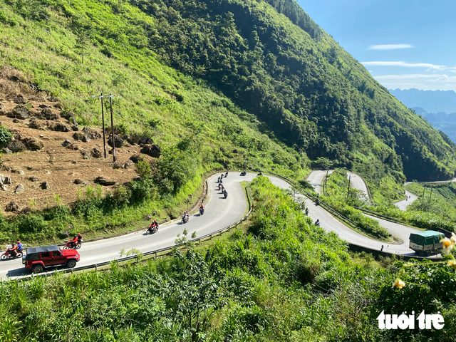
Winding mountain passes in Tuyen Quang Province are popular among international travelers. Photo: M. Phuc / Tuoi Tre
The routes, suitable for exploration by car or motorbike, range from a short 20-kilometer journey over Hai Van Pass to an epic 1,880-kilometer drive along the Ho Chi Minh Highway.
Ha Giang Loop – 350 km
The Ha Giang Loop in northern Vietnam is known for its winding mountain roads, dramatic valleys, and breathtaking views.
The route takes travelers through Yen Minh, Dong Van, and Meo Vac, passing communities of at least 10 ethnic minority groups.
Along the way, visitors can explore caves, trek through mountainous terrain, take boat trips, or stop at waterfalls and roadside eateries.
Lonely Planet singles out Ma Pi Leng Pass as the most scenic stretch of the journey, where jagged limestone mountains tower above the emerald-green Nho Que River.
Travelers are encouraged to take their time exploring the route, with opportunities to photograph terraced rice fields and cornfields stretching across the mountainsides.
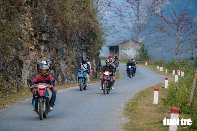
Tourists explore the Ha Giang Loop. Photo: Nam Tran / Tuoi Tre
Cao Bang to Ban Gioc Waterfall – 80 km
The 80-kilometer route from Cao Bang to Ban Gioc Waterfall offers some of northern Vietnam's most picturesque rural scenery, featuring lush farmland, traditional stilt houses, and clear lakes.

Ban Gioc Waterfall in autumn. Photo: Bui Van Hai
A highlight is the 3.5-kilometer Ma Phuc Pass, known for its seven winding bends and sweeping views of terraced fields.
Travelers can also visit Nguom Ngao Cave before reaching Ban Gioc Waterfall on the Vietnam-China border.
The waterfall plunges more than 30 meters over multiple tiers surrounded by greenery, creating a spectacular natural setting.
Visitors can admire the cascading waters from viewing platforms or take a bamboo raft for a closer look.
Lonely Planet recommends the journey as a standalone trip or an extension of the Ha Giang Loop.
Da Lat to Nha Trang – 134 km
Connecting the cool Central Highlands city of Da Lat with the sunny coastal destination of Nha Trang, this 134-kilometer route takes travelers through contrasting landscapes and climates.

The journey begins amid pine-covered hills and French-era architecture before descending through mountainous terrain and small villages toward the coast.
Along National Highway 27C, travelers can enjoy sweeping views of the highlands before reaching Nha Trang's turquoise waters and sandy beaches.
Visitors are recommended setting off early to make the most of the changing scenery along the way.
Hai Van Pass – 20 km
Once notorious for its sharp bends and challenging road conditions, Hai Van Pass has become a favorite among road trip enthusiasts since the opening of the Hai Van Tunnel in 2005 reduced traffic on the mountain route.
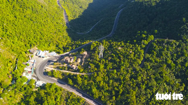
A winding stretch of Hai Van Pass. Photo: TTO
The 20-kilometer stretch between Da Nang and Lang Co Beach offers dramatic views, with forest-covered mountains on one side and steep cliffs overlooking the East Sea on the other.
According to Lonely Planet, the breathtaking scenery has made Hai Van Pass one of the world's most photographed roads on Instagram, with 4,298 photos per mile.
Travelers can stop for Vietnamese iced coffee along the route or visit Hai Van Gate, a historic fortification overlooking the surrounding mountains and coastline.
Ho Chi Minh City to My Tho – 70 km
For travelers seeking a slower pace, Lonely Planet recommends the 70-kilometer journey from Ho Chi Minh City to My Tho in the Mekong Delta.
Leaving the bustling city behind, visitors encounter coconut palms, banana plantations, winding canals, and lush rice paddies.
Rather than rushing to their destination, travelers are encouraged to explore narrow riverside roads and quiet rural lanes, where daily life moves at a gentler pace.
My Tho is known for its pork-and-shrimp noodle soup and local cultural experiences.
Those wishing to extend their journey can continue to the flower-growing areas of Sa Dec or Can Tho, known for its floating market.
Con Dao Coastal Road
A motorbike ride around Con Son, the largest island in the Con Dao archipelago, offers travelers access to secluded beaches, forested hillsides, and scenic coastal roads.
The 25-kilometer route begins at Dam Trau Beach near the airport and winds past a former French colonial prison and several beaches that emerge at low tide before reaching Ben Dam Port.
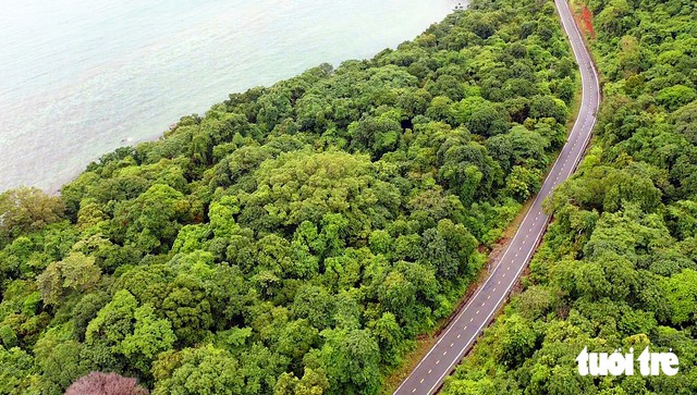
A scenic coastal road around Con Dao. Photo: TTO
Con Dao is also an important nesting ground for green sea turtles.
Lonely Planet recommends visiting between March and May, when calm seas and clear underwater visibility provide favorable conditions for snorkeling and diving.
For those interested in the sea turtle nesting season, June to September is the recommended period.
Ho Chi Minh Highway – 1,880 km
The longest route on Lonely Planet's list is the 1,880-kilometer Ho Chi Minh Highway, connecting Ho Chi Minh City with Hanoi.
The journey, which ideally takes around two weeks, follows sections of a historic route once used to transport troops and supplies during the war.
Travelers pass through peaceful villages, coffee-growing highlands, dense forests, and mountainous landscapes along the Truong Son range.
Among the recommended stops are Phong Nha-Ke Bang National Park, home to Son Doong, the world's largest known cave by volume, and Cuc Phuong National Park, Vietnam's oldest national park.

Tourists visit Cuc Phuong National Park.
The journey ends in Hanoi, where the bustling streets of the Old Quarter contrast with the tranquil countryside along the route.
Lonely Planet also advises international visitors planning to drive in Vietnam to ensure they hold valid driving documents, including an appropriate International Driving Permit issued under the 1968 Vienna Convention and a driving license covering the vehicle they intend to use.


Max: 1500 characters
There are no comments yet. Be the first to comment.