
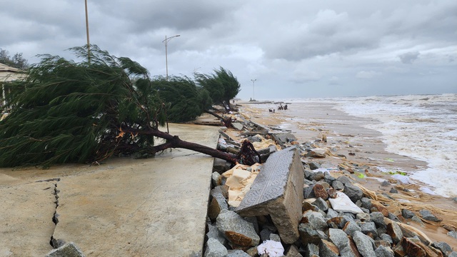
Marine weather conditions in Vietnam are expected to worsen due to a tropical convergence zone linked to a low-pressure system. Photo: Nhat Linh
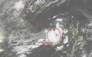
The National Center for Hydro-Meteorological Forecasting reported that a tropical convergence zone is stretching across the northern East Vietnam Sea, linking to the low-pressure area northeast of Luzon.
As a result, scattered showers and thunderstorms have affected the Gulf of Tonkin, the waters from southern Quang Tri to Quang Ngai, as well as parts of the East Vietnam Sea, including Vietnam’s Hoang Sa (Paracel) and Truong Sa (Spratly) special zones.
The low-pressure zone is slowly moving west-northwest and could strengthen into a tropical depression.
Due to the combined influence of the tropical convergence zone and the low-pressure area, scattered thunderstorms and showers are expected across the Gulf of Tonkin, the entire East Vietnam Sea, and the coastal waters from southern Quang Tri to Quang Ngai, Ca Mau to An Giang, and the Gulf of Thailand.
Thunderstorms may bring whirlwinds, wind gusts of level 6-7 (39-61kph) on the Beaufort scale, and waves over two meters high.
The coastal areas from Lam Dong to Ca Mau are forecast to experience southwest winds at level 5-6 (29-49kph), with gusts reaching level 7 (50-61kph).
Wave heights in these areas may range from two to three meters, causing rough seas.
All vessels operating in these waters should stay alert to potential threats from whirlwinds and strong winds.

Max: 1500 characters
There are no comments yet. Be the first to comment.