Vietnam uses AI, satellite images to assess school zone traffic safety
For the first time in Vietnam, artificial intelligence (AI), satellite imagery, and Street View images are being introduced as technical tools to evaluate traffic safety around schools.

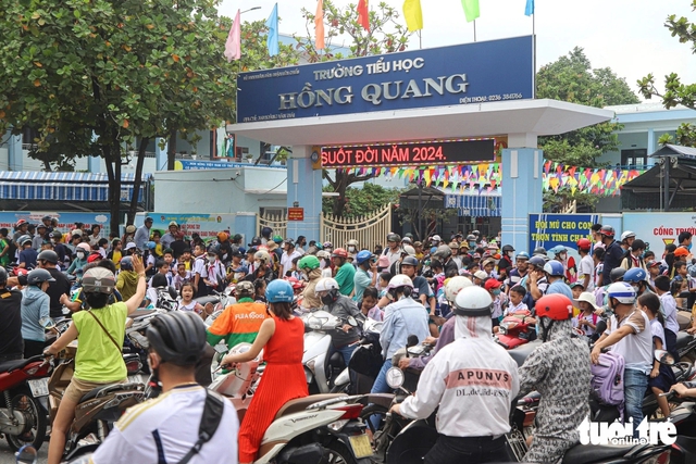
Traffic congestion builds up in front of a school gate in Da Nang City, central Vietnam during rush hour. Photo: Thanh Nguyen
The update was announced at an international workshop about training on safety assessment and implementation of infrastructure and traffic management solutions for school zones, co-organized by the Ministry of Construction and the Asia Injury Prevention (AIP) Foundation on Thursday in Da Nang City, central Vietnam.
The current Ministry of Construction is a merger of the transport ministry and the construction ministry as part of a nationwide administrative restructuring drive.
According to the World Health Organization, nearly 1.3 million people die in road traffic crashes annually, causing economic losses of approximately US$100 billion.
In Vietnam, over 2,000 child-related traffic incidents were reported last year, resulting in nearly 900 deaths.
Hoang The Tung, deputy head of the Department of Transport and Traffic Safety under the Ministry of Construction, stressed that road traffic accidents are a global issue and particularly severe among school-aged children.
During the workshop, staff from the Department for Roads of Vietnam and local construction departments were trained on how to use the Safe School Zone Guide and assess road safety levels around schools by using the star rating methodology provided by the International Road Assessment Program (iRAP).
iRAP is a registered charity with a vision for a world free of high-risk roads, influencing road infrastructure safety in more than 170 countries.
This training aims to help government agencies and local authorities effectively implement infrastructure and traffic management solutions around schools, thereby reducing injuries and fatalities among students.
“The training also offers an opportunity for Vietnam’s traffic management agencies to enhance cooperation with AIP and other international organizations in improving traffic infrastructure and ensuring child safety on the road,” Tung said.

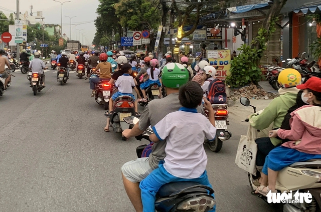
Some Vietnamese students are seen traveling on the street without helmets. Photo: Thanh Nguyen
At the training session, experts introduced three key tools currently being applied to improve traffic safety near schools, including the Safe School Zone Guide, big data screening, and Star Rating for Schools.
The Safe School Zone Guide is a national reference material issued by the then-Ministry of Transport, now the Ministry of Construction, in August 2023.
It has been applied in several school zone infrastructure upgrade projects across Vietnam.
Big data screening, a newly introduced method combining AI, satellite imagery, and 360-degree Street View data, was presented as an innovative approach for analyzing school zone traffic risks.
The Star Rating for Schools (SR4S) tool, developed by the iRAP, allows technical staff and policymakers to assess the safety level of individual school locations and propose tailored interventions.
Minh Duy - Chau Sa / Tuoi Tre News
Link nội dung: https://news.tuoitre.vn/vietnam-uses-ai-satellite-images-to-assess-school-zone-traffic-safety-103250807165020645.htm