
Which areas of Ho Chi Minh City will become low-emission zones from mid-2027?
Ho Chi Minh City plans to designate several areas as low-emission zones from mid-2027, where gasoline- and diesel-powered vehicles will face restrictions.
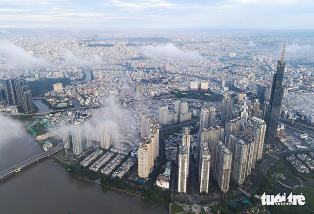
Parts of central Ho Chi Minh City will restrict gasoline- and diesel-powered vehicles as the city rolls out low-emission zones from mid-2027. Photo: Le Phan / Tuoi Tre
According to the draft proposal on vehicle-emission controls in Ho Chi Minh City, a low-emission zone (LEZ) would be established in central areas with poor air quality, heavy traffic, and high population density.
The proposed criteria include high levels of PM2.5 and PM10 and an air quality index (AQI) above national standards, traffic congestion at levels D to F, and public transportation coverage of more than 85 percent within a 500-meter radius.
The area must also have clear infrastructure boundaries to allow vehicles entering and leaving the zone to be controlled.
Based on these criteria, the proposal identifies two areas for potential implementation.
Area 1: Existing central area and Thu Thiem
The first area covers the existing 930-hectare central area and Thu Thiem Urban Area in An Khanh Ward, bounded by Saigon Bridge, Nguyen Huu Canh, Van Thanh 2 Bridge, Thi Nghe 2 Bridge, Hoang Sa, Vo Thi Sau, Cach Mang Thang Tam, Nguyen Thai Hoc, Vo Van Kiet, Saigon River Tunnel, Thu Thiem, Tran Quy Kien, Mai Chi Tho, Luong Dinh Cua, Tran Nao, and back to Saigon Bridge.
The area covers 16.6 square kilometers and has a population of about 176,201.
It is estimated to generate 0.091 metric tons of fine particulate matter per day per square kilometer, with total traffic of around 685,195 vehicles a day.
Public transportation covers 95.91 percent of the area.
The city plans to pilot the LEZ in this area from July 1, 2027 through December 31, 2028.
Area 2: Ring-road corridor
The second area would follow a ring-road corridor comprising Do Muoi, Le Duc Anh, Le Kha Phieu, Nguyen Van Linh, the approach road to Phu My Bridge, Phu My Bridge, Vo Chi Cong, Nguyen Thi Dinh, Dong Van Cong, Mai Chi Tho, Vo Nguyen Giap, and Hanoi Highway, before connecting back to Do Muoi.
This area would cover about 280 square kilometers, with an estimated population of 6.17 million.
It has an estimated PM2.5 concentration of about 58 kilograms per day per square kilometer, while total traffic is around 11.56 million vehicles a day.
Public transportation coverage stands at 87.32 percent.
Under the proposal, Phase 2 would begin January 1, 2029, expanding the LEZ from Area 1 to Area 2.
Priority areas for green transportation
The proposal also identifies Con Dao Special Zone, about 230 kilometers south of Ho Chi Minh City, is also identified as a priority area for an early transition to green transportation.
The area would receive higher levels of support because of its earlier implementation timeline, limited number of vehicles, island conditions, and specific environmental protection requirements.
The transition would need to be accompanied by local bus services, charging stations, battery-swapping cabinets, renewable energy, vehicle management, battery collection, and public communication targeting residents, businesses, and visitors.
Meanwhile, among the four former Can Gio district communes, Thanh An Island Commune in southeastern Ho Chi Minh City is considered well positioned for an earlier transition to green transportation.
The area is planned for eco-tourism linked to mangrove conservation, while motorcycles are the main form of private transportation.
Switching to green vehicles could help reduce greenhouse gas emissions, limit noise pollution, and improve environmental quality.


Van Giang - Le Phan / Tuoi Tre News
Link nội dung: https://news.tuoitre.vn/which-areas-of-ho-chi-minh-city-will-become-low-emission-zones-from-mid-2027-103260826131005212.htm