


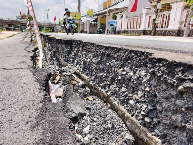
Severe riverbank erosion has cracked the road in front of the Dai Hai Commune People’s Committee office in Can Tho City, prompting authorities to cordon off the area as a warning. Photo: Chi Quoc / Tuoi Tre
Unpredictable flood seasons, depleted sediment supplies and falling groundwater levels during dry periods are among the factors driving erosion across the region.
The damage has been particularly serious along rivers, where generations of residents have built homes and businesses.
Nearly 200 erosion sites recorded in Can Tho
Standing beside a river in Dai Hai Commune, Can Tho City, local resident Le Thanh Nhan said he was worried after hearing that the coming drought and saltwater intrusion season could arrive early and become more severe due to El Nino.
He fears stronger riverbank erosion could leave local residents struggling to protect their homes.
Since the beginning of this year, Can Tho has recorded around 200 riverbank and coastal erosion sites spanning nearly 30 kilometers.
Ten houses have completely collapsed into rivers, while more than 70 others have been affected.
According to the Can Tho Department of Agriculture and Environment, erosion has also forced authorities to relocate electricity and water infrastructure and disrupted several rural roads, affecting residents' travel and daily activities.
The city estimates that about VND1.001 trillion (US$38.5 million) is needed to reinforce and repair the affected areas.
In Dai Hai Commune, severe erosion has occurred along an approximately 800-meter section of Canal No. 1, from Mang Ca 2 Bridge to the entrance of Ba Rinh Canal.
A 225-meter reinforced concrete embankment has been seriously damaged.
The top of the embankment has shifted 0.1-0.9 meters toward the river, while the sidewalk, drainage system and half of the road have subsided by 0.2-0.5 meters.
The area is near the Dai Hai Commune People's Committee office, Dai Hai 2 Primary School, Dai Hai 2 Secondary School and a densely populated residential area.
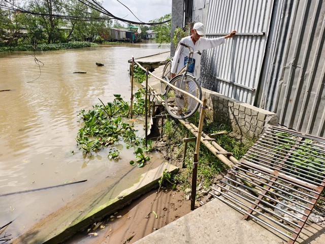
Riverbank erosion has cut off roads and severely disrupted the lives of residents in Dai Hai Commune, Can Tho City. Photo: Chi Quoc / Tuoi Tre
Nhan said many students and residents pass through the area every day, while the deteriorating embankment and subsiding road pose safety risks.
"Residents hope the authorities will repair it soon to ensure everyone's safety," he said.
Another section of the Mang Ca-Dai Thanh road in the commune has suffered erosion over a stretch about 15 meters long and eight meters wide, forcing residents to take a detour.
Ha Thanh Liem, vice chairman of the Dai Hai Commune People's Committee, said the city had declared an emergency over the dangerous erosion along Canal No. 1.
Authorities have approved a VND35 billion ($1.35 million) project to reinforce a 238-meter section of the canal bank.
Across the Mekong Delta, 812 erosion sites with a combined length of more than 1,210 kilometers were recorded between 2016 and May 2026, according to the Vietnam Disaster and Dyke Management Authority under the Ministry of Agriculture and Environment.
Of these, 315 sites covering 619 kilometers were classified as particularly dangerous, directly threatening dikes, residential areas and key infrastructure, while also causing significant losses of land and mangrove forests.
'Hungry' rivers increase erosion risk
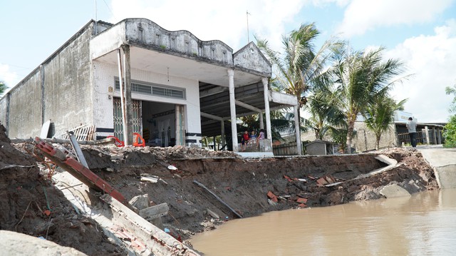
A riverbank erosion incident in Dat Moi Commune, Ca Mau Province, in July swept away several houses and sections of road. Photo: Thanh Huyen / Tuoi Tre
Ca Mau Province, located downstream of the Mekong's river network, receives relatively little sediment.
The province is surrounded by the sea on three sides and has an extensive network of rivers and canals, supporting aquaculture and waterway transportation.
However, generations of settlement along riverbanks have left homes, businesses and roads vulnerable to erosion.
Besides climate change and rising tides, depleted sediment supplies, excessive groundwater extraction, construction along riverbanks and changes in river flows have worsened the situation.
About 424 kilometers of riverbanks across Ca Mau are affected by erosion, according to local statistics.
Since the beginning of the year, the province has recorded 84 cases of riverbank erosion and land subsidence, affecting more than 2.2 kilometers of riverbanks and 77 homes.
Erosion has recently occurred along the Trai Luoi River, Cua Lon River and Ganh Hao River, as well as several other waterways.
In July, a roughly 25-square-meter house belonging to Luong Thi Ut Muoi, 38, in Dat Moi Commune was swept into the river.
Muoi recalled that she and her two young children were sleeping at around 1:30 am when they heard a loud noise from the roof.
Within minutes, the house split apart and collapsed into the river.
Another Dat Moi resident, Do Van Em, said dense construction had placed greater pressure on riverbanks.
When water levels fall, the soil can collapse, he said.
Em has already lost one house to erosion and is now worried because he has no land left to retreat to.
In response, the Ca Mau provincial administration has instructed relevant agencies to urgently address the damage and help affected residents stabilize their lives.
The Department of Agriculture and Environment has been tasked with leading field inspections, determining the causes of erosion, proposing remedial measures and coordinating damage assessments.
The Department of Construction will assess the safety of riverside homes and other structures and provide guidance on reinforcement, demolition or emergency relocation, while the Department of Finance will advise on funding arrangements.
The provincial Vietnam Fatherland Front Committee and Civil Defense Command are ready to mobilize personnel and equipment to support the relocation of residents from high-risk areas.
Billions of dollars needed to tackle erosion
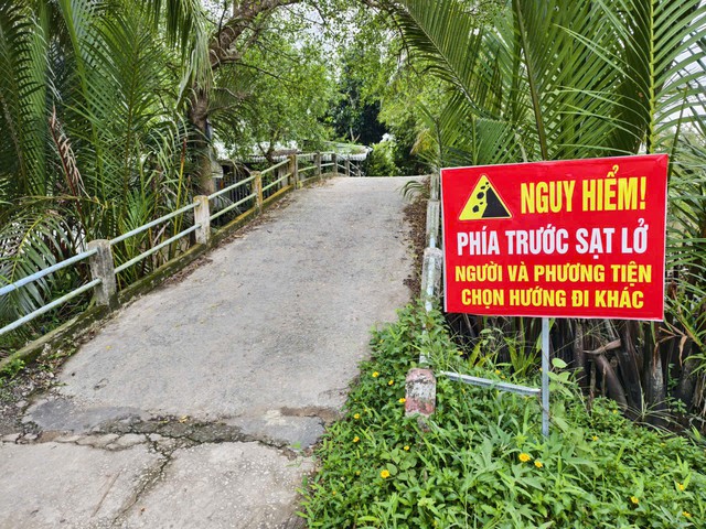
Warning signs about the risk of riverbank erosion are seen across the Mekong Delta. Photo: Chi Quoc / Tuoi Tre
Ca Mau has developed a plan to prevent and control erosion through 2030, with a vision toward 2050, as part of a broader Mekong Delta program.
The province has identified 235 projects involving riverbank and coastal protection, residential infrastructure and reforestation, with total estimated funding of VND35.037 trillion ($1.35 billion).
The central government is expected to provide about VND25.132 trillion ($966.6million), while VND1.104trillion ($42.5 million) would come from loans, VND5.26 trillion ($202.3million) from the provincial budget and VND3.541 trillion ($136.2 million) from socialized funding.
The plan is divided into three phases.
From 2021 to 2025, 12 projects were planned at a cost of more than VND3 trillion ($115.4 million).
The 2026-2030 phase includes 107 projects costing more than VND16 trillion ($615.4million), while 116 projects worth more than VND15.9trillion ($611.5 million) are planned after 2030.
In former Bac Lieu Province, now part of Ca Mau Province, authorities have identified 50 projects requiring an estimated VND28 trillion ($1.08 billion) through 2030.
Five urgent projects involving river embankments, dikes and resettlement require about VND3.4 trillion ($130.8 million).
Ca Mau authorities have asked agencies to review projects involving the upgrading of riverside residential areas and the relocation of households to protect lives and property.
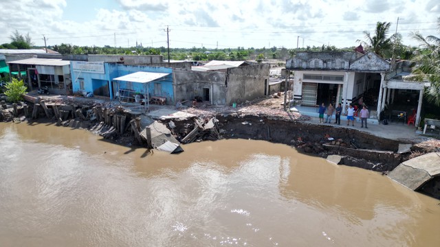
The longstanding practice of living and doing business along rivers in the Mekong Delta, particularly in Ca Mau, has made the consequences of erosion more severe. Photo: Thanh Huyen / Tuoi Tre
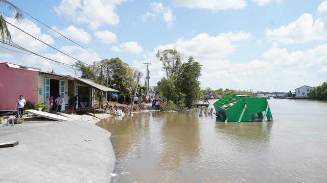
A riverbank erosion incident pulled an entire concrete house in Dam Doi, Ca Mau Province, into the river. Photo: Thanh Huyen / Tuoi Tre
In Can Tho, city chairman Truong Canh Tuyen has ordered communes and wards to speed up procedures for declaring natural disasters at urgent erosion sites so that repair projects can be implemented and funds disbursed.
The city's Department of Finance has proposed allocating more than VND200 billion ($7.7 million) to help localities deal with damage caused by floods, natural disasters and erosion.
Tuyen said weather and climate change would remain complicated through the end of 2026, with extreme heat, water shortages, drought, saltwater intrusion, strong storms and localized heavy rain potentially increasing the risks of erosion, urban flooding and dike failures.
He urged local authorities to prepare for disasters that could occur more quickly, affect larger areas and become increasingly complex.








Max: 1500 characters
There are no comments yet. Be the first to comment.