
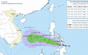
A satellite image shows the position and forecast track of storm Koto, as recorded at 7:00 am on November 26, 2025. Photo: Vietnam Disasters Monitoring System
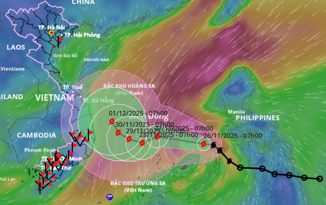
The National Center for Hydro-Meteorological Forecasting reported that Koto's center at 7:00 am on Wednesday was located about 440 kilometers east of Song Tu Tay Island, with sustained winds of 62-74 kph and gusts of 89-102 kph. The storm was moving northwest at 25 kph.
Koto is expected to strengthen as it moves west-northwest at 20-25 kph during the next 24 hours.
By 7:00 am on Thursday, its center is projected to lie over the central East Vietnam Sea, about 170 kilometers north of Song Tu Tay, with winds of 89-102 kph and gusts of 134-149 kph.
In the following 24-48 hours, the storm is forecast to shift west-southwest and continue intensifying.
By 7:00 am on Friday, Koto is expected to reach 103-117 kph, with gusts of 150-166 kph, located about 160 kilometers northwest of Song Tu Tay.
From 48 to 72 hours, the storm will likely slow to about 5 kph while moving westward, maintaining its strength.
By 7:00 am on Saturday, its center is expected to remain over the western part of the central East Vietnam Sea, about 270 kilometers west-northwest of Song Tu Tay, still with winds of 103-117 kph and gusts of 150-166 kph.
In the 72-120 hour period, the system will weaken gradually while tracking northwest at around 5 kph.
Due to Koto's effects, the central East Vietnam Sea, including waters north of Vietnam's Truong Sa (Spratly) Special Zone, has seen winds of 39-61 kph, increasing to 62-102 kph near the storm's center, with gusts of 134-149 kph. Waves near the center have reached 4-8 meters.
From Thursday through Friday, the same region is likely to experience winds of 103-117 kph and waves of 7-9 meters, creating extremely rough seas.
All vessels in the area face risks from thunderstorms, strong winds, and dangerous high waves.
Flood-hit Khanh Hoa prepares emergency measures
The People's Committee of Khanh Hoa, one of the south-central provinces hit hard by last week's floods, held a meeting on Tuesday to coordinate storm preparations.
Nguyen Duy Quang, director of the provincial Department of Agriculture and Environment, said evacuation plans will be activated if Koto directly affects the province. Local authorities will assist residents in reinforcing homes.
Commune and ward authorities, along with the provincial military command and border guard forces, have been instructed to carry out evacuations based on real-time developments.
Reservoir operators have been told to monitor rainfall and river flows closely, adjusting discharges to protect dam safety and prevent downstream flooding.
Tran Phong, chairman of the provincial administration, said all localities must have detailed evacuation plans, ensure safe shelters, elevate valuables during flooding, and stock essential supplies.
For households whose homes collapsed or were badly damaged in the recent historic floods, Le Huyen, vice-chairman of the provincial administration, said they will be evacuated immediately if Koto threatens the region.
Two major reservoirs, Song Cho 1 and Suoi Dau, began lowering water levels on Monday to prepare for incoming rain.

Residents in Nha Trang of Khanh Hoa Province, south-central Vietnam evacuate from deeply flooded areas during recent historic rains, November 2025. Photo: Tran Hoai / Tuoi Tre
According to a provincial report as of 9:00 am on Tuesday, the recent floods in Khanh Hoa killed 22 people and injured 20. A total of 105 homes were destroyed and 909 others were damaged.
Losses to irrigation and dike systems are estimated at about VND1.73 trillion (US$66 million).
Damage to transport infrastructure is estimated at about VND1.97 trillion ($75 million), with around 381 kilometers of roads damaged or blocked by landslides.
Education sector losses reached about VND80 billion ($3 million), healthcare about VND170 billion ($6.5 million) and industry and trade around VND191.5 billion ($7.3 million).

Max: 1500 characters
There are no comments yet. Be the first to comment.