
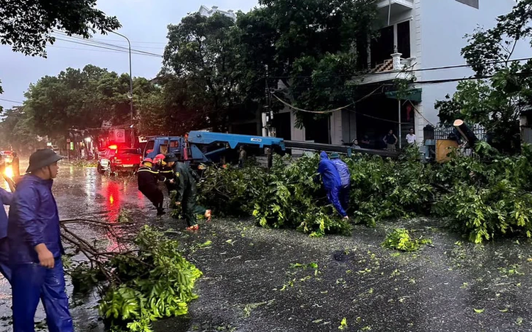
Authorities in Mong Cai 2 Ward, Quang Ninh Province, northern Vietnam, clear trees toppled by Storm Maysak. Photo: Mong Cai 2 Ward Military Command
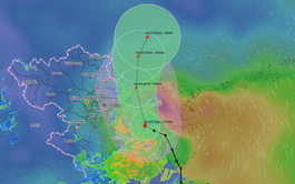
The storm made landfall in Mong Cai at around 7:30 pm on Saturday with sustained winds of level 9-10 (75-102 km/h) and gusts reaching level 11.
Instead of passing through quickly, Maysak moved slowly and maintained its strength for several hours, battering both coastal and inland areas of Mong Cai with powerful winds and heavy rain.
Storm Maysak damages numerous structures in Mong Cai, Quang Ninh Province, northern Vietnam. Photo: Dong Bac
By 4:00 am on Sunday, although the storm's center had crossed into China's Guangxi, it remained strong enough to pose risks to local residents.
Rain continued to fall across Mong Cai on Sunday morning, although winds had begun to weaken. Authorities warned that many areas remained at risk of flooding.
Nguyen Van Hau, a resident of Mong Cai 1 Ward, said the storm raged throughout the night, preventing many residents from sleeping.
"The winds only started to ease by daybreak, but the rain remained extremely heavy," he said.
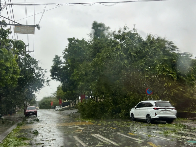
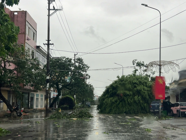
Fallen trees block multiple roads in Mong Cai, Quang Ninh Province, northern Vietnam. Photo: Dong Bac
In response to the storm, authorities in Mong Cai 1 Ward evacuated eight households from the Hai Hoa 1, Hai Hoa 2, and Hai Hoa 6 neighborhoods to safer locations after flooding affected their homes.
Meanwhile, rescue forces in Mong Cai 2 Ward successfully secured four boats after they broke free from their moorings at the natural anchorage near Do Mountain.
The storm submerged about 600 hectares of aquaculture farms in the Hai Hoa 1, Hai Hoa 2, and Hai Hoa 6 neighborhoods of Mong Cai 1 Ward.
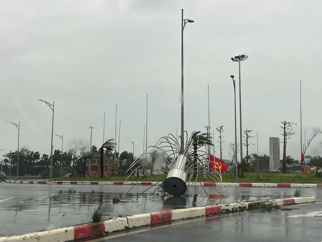
It also damaged more than 10 street-light poles, toppled over 800 trees, ripped the roofs off more than 30 houses, and caused widespread power outages.

Sheets of metal roofing are blown onto streets by strong winds in Mong Cai, Quang Ninh Province, northern Vietnam. Photo: Dong Bac
Quang Ninh authorities maintained around-the-clock emergency operations and mobilized personnel and equipment to respond quickly to emergencies and minimize storm-related losses.
Under the storm's influence, many locations across Quang Ninh recorded rainfall exceeding 200 millimeters, with some areas receiving nearly 300 millimeters.
Water levels on the Tien Yen River were rising rapidly and were forecast to peak on Sunday morning.
Powerful winds topple numerous trees across Mong Cai, Quang Ninh Province, northern Vietnam. Photo: Dong Bac
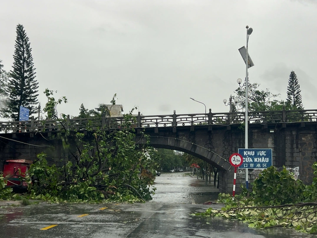
The Mong Cai border gate area after the storm. Photo: Dong Bac

Signs and metal roofing are scattered across roads in Mong Cai, Quang Ninh Province, northern Vietnam. Photo: Dong Bac

Many streets in Mong Cai, Quang Ninh Province, northern Vietnam suffer extensive storm damage. Photo: Dong Bac
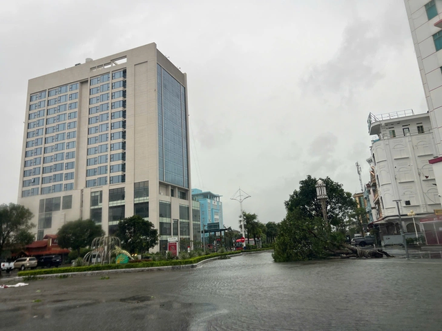
Strong, sustained winds uproot many large trees in Mong Cai, Quang Ninh Province, northern Vietnam. Photo: Dong Bac
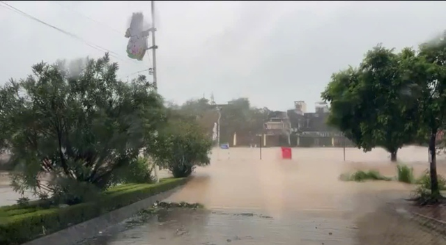
Heavy rain and strong winds cause flooding in several parts of Mong Cai in Quang Ninh Province, northern Vietnam. Photo: Dong Bac

An uprooted tree lies on the ground in Mong Cai, Quang Ninh Province, northern Vietnam. Photo: Dong Bac

Residents are evacuated to safe locations. Photo: Mong Cai 2 Ward Military Command

Max: 1500 characters
There are no comments yet. Be the first to comment.