
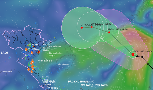
Satellite imagery shows the projected path of storm Mitag, the eighth storm to hit the East Vietnam Sea in 2025, at 4:00 pm on September 18, 2025. Photo: Vietnam Disasters Monitoring System
At 4:00 pm on Thursday, the center of Mitag, the eighth storm to hit the East Vietnam Sea this year, was located in the northeastern part of the maritime area with sustained winds of 62-74 kph and gusts up to 89-102 kph.
Mitag was traveling northwest at 15-20 kph and may intensify further within the next 24 hours.
By 4:00 pm on Friday, the storm is expected to be off the coast of Guangdong Province, China, with winds of 75-88 kph and gusts up to 103-117 kph.
It will likely weaken into a tropical depression after making landfall, before dissipating overland on Saturday.
Strong winds of 39-61 kph, gusting to 90 kph, and waves up to five meters are forecast in the northeastern East Vietnam Sea, with conditions near the storm’s center reaching 62-88 kph and gusts up to 103-117 kph.
Vessels in these dangerous zones face risks from thunderstorms, squalls, and rough seas.
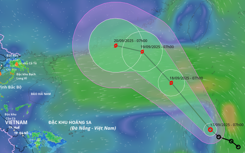
The national weather agency warned that northern Vietnamese provinces could experience two rounds of heavy rainfall on September 22-23 and again on September 24-25.
Widespread downpours are also expected in north-central provinces from Thanh Hoa to Ha Tinh, starting September 19 and intensifying between September 22 and 25.
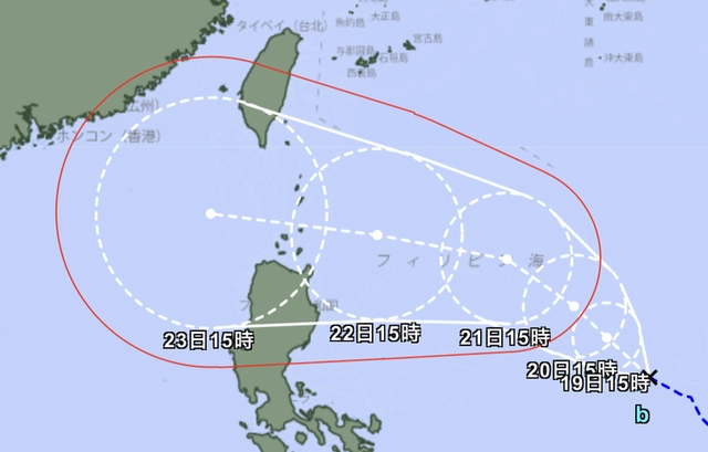
A map shows a tropical depression strengthening east of the Philippines. Photo: Japan Meteorological Agency
Meanwhile, the Japan Meteorological Agency reported another tropical depression east of the Philippines.
It is forecast to strengthen into a storm within 24 hours, track north of Luzon Island, and may enter the East Vietnam Sea around September 23 with increasing intensity.

Max: 1500 characters
There are no comments yet. Be the first to comment.