
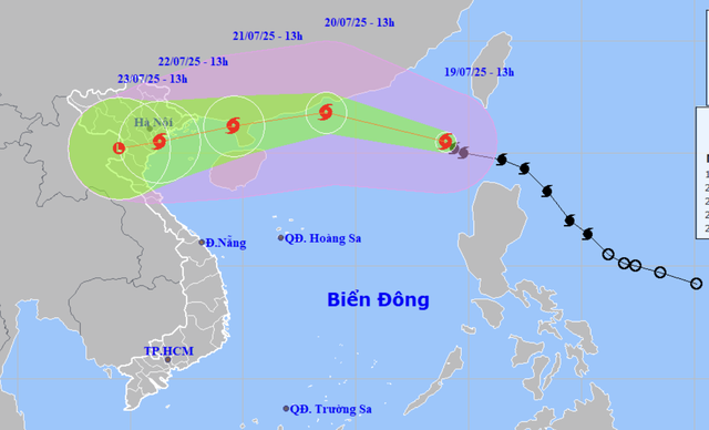
A map shows the projected locations and path of storm Wipha, the third storm to hit the East Vietnam Sea in 2025, as of 1:00 pm on July 19, 2025. Photo: Vietnam’s National Center for Hydro-Meteorological Forecasting
According to the National Center for Hydro-Meteorological Forecasting, as of 1:00 pm on Saturday, Wipha’s center was spotted northeast of the northern East Vietnam Sea, with maximum sustained winds reaching level 9-10 (75-102 kph) and gusts up to level 12 (118-133 kph).
Compared to this morning, the storm had intensified by one level.
Forecasters predict that early on Monday next week, Wipha will move into the Gulf of Tonkin.
Then, the system is anticipated to make landfall late on Monday or early on Tuesday, likely hitting the coast between Quang Ninh and Thanh Hoa Provinces.
Storm surge in coastal areas of Quang Ninh and Hai Phong City could reach 0.6-0.9 meters, potentially combining with high tides and large waves to cause flooding in low-lying zones by Monday and Tuesday afternoons.
From July 21 to 24, heavy downpours are expected in the northern midlands, Red River Delta, and the north-central provinces of Thanh Hoa, Nghe An, and Ha Tinh.
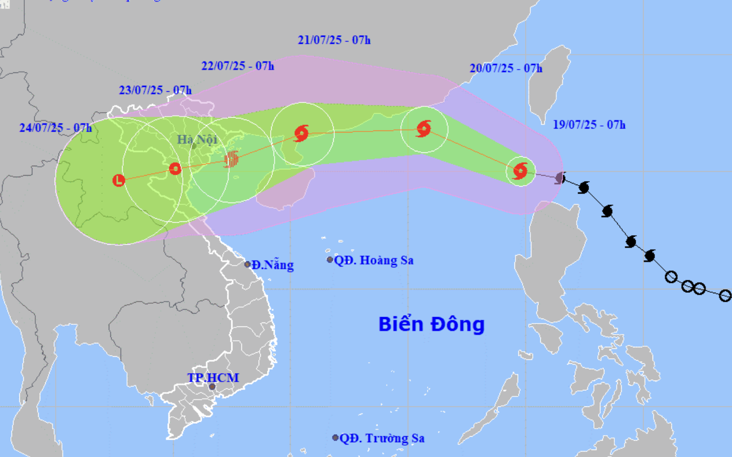
In the next 24 hours, Wipha is forecast to move west-northwest at around 20kph and may continue to strengthen.
By 1:00 pm on Sunday, its center could be about 370 km east of China’s Leizhou Peninsula with winds expected to reach level 11-12 (103-133 kph), gusting up to level 15 (167-183 kph).
Between 24 and 48 hours, the storm will possibly travel west-southwest at 15-20 kph and make landfall on the Leizhou Peninsula.
By 1:00 pm on Monday, its center could be near the western coast of the peninsula with wind strength at level 10-11 (89-117 kph), gusting to level 13 (134-149 kph).
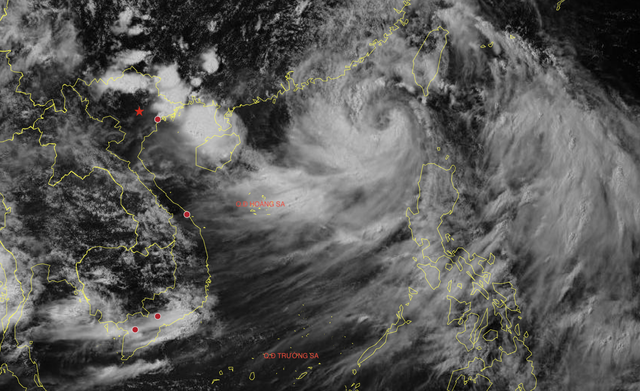
Satellite image at 1:50 pm on July 19, 2025 shows storm Wipha forming a visible eye. Photo: Vietnam’s National Center for Hydro-Meteorological Forecasting
In the following 48 to 72 hours, Wipha will probably move into the Gulf of Tonkin and then inland across northern Vietnam.
By 1:00 pm on Tuesday, Wipha could be located over the Red River Delta and Thanh Hoa with reduced wind speeds at level 8 (62-74 kph), gusting to level 10 (89-102 kph), before weakening further.
Strong winds of level 8-10 (62-102 kph) are already being recorded in the northern East Vietnam Sea, with areas near the storm center reaching level 11-12 (103-133 kph) and gusting up to level 15 (167-183 kph).
Waves are expected to rise between four to six meters, creating extremely rough seas.
Vessels operating in the affected zones face high risks from thunderstorms, squalls, strong winds, and high waves.

Max: 1500 characters
There are no comments yet. Be the first to comment.