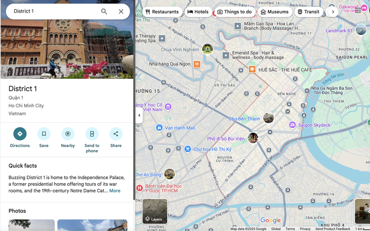
Location data on Google Maps still displays results based on Vietnam’s previous administrative structure.
Vietnam reduced its provincial-level administrative units from 63 to 34, including 28 provinces and six centrally-governed cities, and implemented a two-tiered system, consisting of provinces/cities and wards/communes, nationwide on July 1.
Despite the official changes, Google services such as Search, Maps, and Gemini were still showing the old three-tiered system and outdated provincial boundaries as of Monday.
“The updating of legal administrative data must come from official sources,” said Le Minh, chief technology officer at CMC TS, a Vietnamese IT firm.

Le Minh, chief technology officer at Vietnamese IT firm CMC TS. Handout via Tuoi Tre
He told Tuoi Tre (Youth) newspaper that Google relies on both government data and user feedback to validate updates.
Minh said even advanced AI models like Gemini must be retrained or fine-tuned to incorporate new data; otherwise, they will continue to present outdated information.
The delay in updating administrative data has affected users who rely on Google’s AI tools and maps for services such as residency registration, tax filing, package delivery, and geographic-based app development.
In response to the nationwide reorganization, Vietnamese tech groups have launched domestic AI platforms to fill the gap.
Telecom giant Viettel introduced a free online assistant at tracuuphuongxa.trolyao.org to help citizens look up the new 34 provinces and 3,321 communes.
Another project, Rabbi, developed by the National Data Center, provides AI-powered local government information.
Nguyen Tuan Quang, project leader, said Rabbi uses official sources to answer public queries in real time during the administrative transition.


Max: 1500 characters
There are no comments yet. Be the first to comment.