
Tropical Storm Dianmu on Friday made landfall in Hai Phong City and Thai Binh Province in northern Vietnam at 2:00 pm, two hours earlier than forecasted.
According to the National Center for Hydro-Meteorological Forecasting, strongest winds near the eye of the storm in the two localities reached 60 - 90kph.
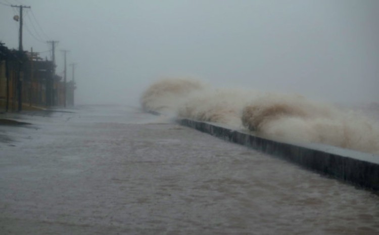
The coastal area from Quang Ninh province to Thai Binh province has seen water rising combined with high tide at 3,0-3,5m.
The storm has also affected the capital city of Hanoi, packing winds of between 39 – 74kph and rainfall at 100-200mm.
Local authorities have directed functional agencies to work 24/7 and regularly report their work on preventing the storm.
It is forecasted that within the next 6 to 12 hours, the storm will move in a west direction at a speed of 20km per hour and will be weakened into tropical depression.
By 10pm today, strongest winds near the tropical depression’s eye onshore northern delta provinces are expected to reach 40 – 60 kph.
At 4:00 am on Thursday, Tropical Storm Dianmu was roaring through the maritime area southwest of China’s Guangdong Province with wind speeds between 60 and 75 kph, according to the National Center for Hydro-Meteorological Forecasting.
The storm was forecast to make landfall in northern Vietnam near Thai Binh Province at 4:00 pm on Friday, with maximum sustained winds ranging from 90 to 120 kph.
Below are photos capturing the storm hiting northen Vietnam in Friday afternoon:

In this photo provided by Hai Phong nothern city's water traffice police, the officers are patrolling against storm.

Power poles broken by the storm in Thai Binh province. Photo:Tuoi Tre

Big waves hit Do Son beach in Hai Phong city. Photo: Tuoi Tre

Big waves hit Do Son beach in Hai Phong city. Photo: Tuoi Tre

Workers are seen reinforcing local shops and restaurants to prevent the storm. Photo: Tuoi Tre

Strong winds and big waves in Nam Dinh province. Photo: Tuoi Tre


Max: 1500 characters
There are no comments yet. Be the first to comment.