
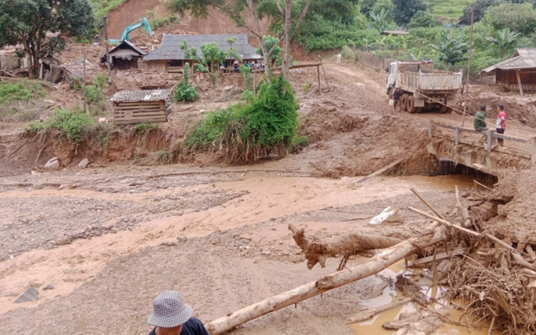
This supplied photo shows an area in Dien Bien Province, northern Vietnam, affected by a flash flood and landslide, August 1, 2025.
Although this is slightly below the historical August average of around 2.4 storms, it still exceeds the long-term mean of 0.8 landfalls per August.
Multiple heavy rain episodes are expected across northern Vietnam and the north-central coast during the month, particularly in the Thanh Hoa–Hue region, where widespread showers and thunderstorms may occur.
The center warns of thunderstorms, hail, whirlwinds, and strong gusts, which could trigger flash floods in small rivers and landslides on steep terrain.
Urban and low-lying coastal areas may face localized flooding during intense downpours.
Heatwaves are forecast to affect northern provinces, the Thanh Hoa–Hue belt, and the southcentral coastal region, especially during the first half of August.
Peak daytime temperatures from Thanh Hoa to Khanh Hoa are forecast at 35–37 degrees Celsius, or higher locally, while the coastal stretch from Da Nang through Quang Ngai into Dak Lak may experience daily highs of 36-38 degrees Celsius or more.
A temporary relief from the heat is forecast to begin around August 5, following the arrival of scattered showers and thunderstorms late on the night of August 4.
Mountainous and midland regions may receive moderate to very heavy rainfall, along with powerful winds, flooding, hail, and lightning in certain rainstorms.
Flash floods and landslides remain possible in mountainous areas, while flooding may hit urban and low-lying zones.
Temperatures in the north are forecast to rebound around August 8, resuming hot and humid conditions.
Meanwhile, the Central Highlands and southern provinces should expect scattered showers or thunderstorms most late afternoons and evenings from now until at least August 10.

Max: 1500 characters
There are no comments yet. Be the first to comment.