
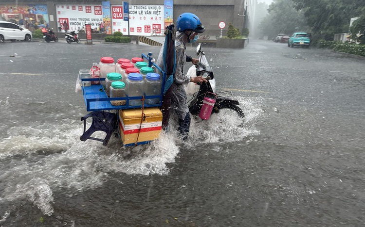
A person transporting various items on a motorbike struggles to navigate a heavily flooded street following heavy rainfall in Ho Chi Minh City, southern Vietnam. Photo: Le Phan / Tuoi Tre
The prolonged downpours are being driven by a combination of a low-pressure trough and intensified southwest monsoon winds, affecting not only the city but much of southern Vietnam.
Since early Thursday, scattered showers and moderate rainfall have already been recorded across districts such as Binh Chanh (37mm) and Cu Chi (29.8mm).
Forecasts indicate that between Thursday and Saturday morning, widespread showers will continue, with some areas likely to receive between 30 and 70mm of rain – or even more in certain spots.
Rainfall totals are expected to reach between 120 and 200mm by May 27. In some locations, the amount could exceed 200mm.
The weather agency has issued alerts for possible flooding in low-lying neighborhoods, urban centers, industrial parks, and areas near rivers and canals.
Prolonged rain also increases the risk of landslides along riverbanks.
The broader southern region is also expected to see significant rainfall during this time. In the past 24 hours, My Tho City in Tien Giang Province has recorded 105.6mm of rain, Gia Rai Town in Bac Lieu has logged 63.2mm, and Mo Cay District in Ben Tre has seen 57mm.
Residents are urged to monitor official weather updates and take precautions to reduce the impact of potential flooding and other rain-related hazards.
The current spell of torrential rain is expected to ease starting May 28, when the forecast begins to shift to more sporadic showers and thunderstorms through the end of the month.
During these rainstorms, residents should remain alert for lightning, strong winds, hail, and localized downpours that could lead to deep flooding on key roads and riverside areas.
In Ho Chi Minh City’s coastal areas, scattered thunderstorms are expected to bring rough seas, whirlwinds, and powerful gusts.


Max: 1500 characters
There are no comments yet. Be the first to comment.