
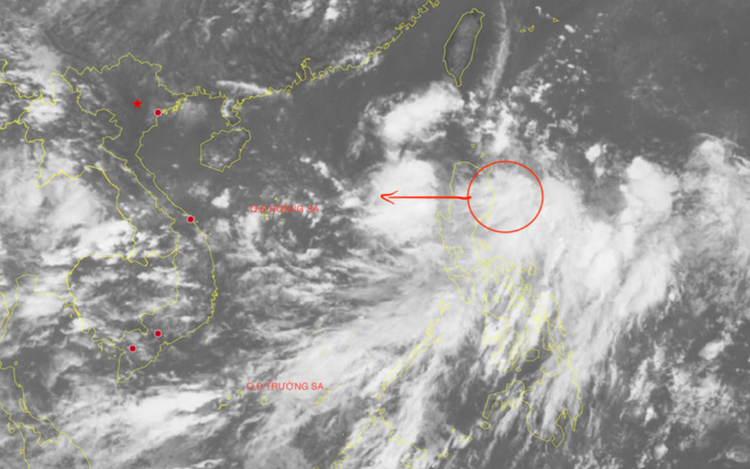
A low-pressure area is moving toward the East Vietnam Sea. Photo: Vietnam’s National Center for Hydro-Meteorological Forecasting
The low-pressure area, coupled with an active intertropical convergence zone, might bring scattered showers and thunderstorms to the eastern waters of the northern and central East Vietnam Sea.
Scattered rainfall and thunderstorms are forecast to lash coastal areas stretching from Lam Dong Province to Ca Mau Province, the Gulf of Thailand, and the northern, central, and southern East Vietnam Sea on Friday.
These thunderstorms may bring strong winds at level 6-7 (39-61 kph), and sea waves exceeding two meters.
All vessels operating in the affected areas face heightened risks due to the potential for squalls and strong gusts.
The national weather center forecast that the number of storms and tropical depressions affecting the East Vietnam Sea in September will be close to the average recorded in previous years, approximately 2.4 systems, with around 1.2 expected to make landfall in Vietnam.
Rainfall across the northern region and provinces from Thanh Hoa to Gia Lai is expected to be 10-25 percent above average for this time of year.
Other regions of the country will likely see rainfall levels near the seasonal norm.
Widespread heavy rain is anticipated in the northern region and provinces from Thanh Hoa to Quang Ngai in September.
Other regions might suffer multiple days of scattered showers and thunderstorms this month, while experiencing some days of moderate to heavy downpours.

Max: 1500 characters
There are no comments yet. Be the first to comment.