
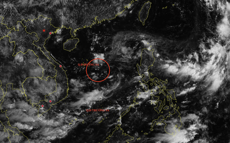
The location of a low-pressure area in the East Vietnam Sea at 1:00 am, September 3, 2025. Photo: The National Center for Hydro-Meteorological Forecasting
The system’s path remains uncertain, and it is not yet clear whether it will strengthen into a tropical depression or storm.
Combined with the tropical convergence zone, the low-pressure area is forecast to produce scattered showers and thunderstorms across several coastal provinces on Wednesday.
Affected maritime zones include the waters off Quang Ngai to Ca Mau Provinces, the Gulf of Thailand, the eastern part of the northern East Vietnam Sea, and both central and southern portions of the sea.
Thunderstorms in these areas may bring waterspouts and strong gusts reaching levels 6 to 7, while waves are expected to exceed two meters.
Vessels operating in these zones face high risks from severe weather, including squalls and strong gusts.
Several inland provinces, particularly from Gia Lai to Lam Dong and throughout the southern region, experienced moderate to heavy rain and thunderstorms from Tuesday night into early Wednesday.
Some areas recorded rainfall up to 313 millimeters.
On Wednesday, more downpours are expected across the Central Highlands and southern provinces, with rainfall ranging between 20 and 40 millimeters, with some areas forecast to see totals surpassing 100 millimeters.
Due to the intense rainfall, authorities have issued alerts for flash floods along small rivers and streams, landslides on steep terrain, and flooding in low-lying areas.
The risk is particularly high in areas receiving over 90 millimeters of rain within a three-hour period.

Max: 1500 characters
There are no comments yet. Be the first to comment.