
No-drone zones near airports in central Vietnam mapped on Google Earth
The military command of Lam Dong Province in Vietnam’s Central Highlands has mapped no-drone and restricted-flight zones around Lien Khuong International Airport and uploaded them to Google Earth to help protect aviation safety.
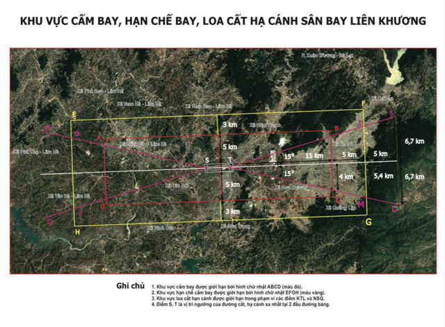
A map shows no-drone zones around Lien Khuong International Airport in Vietnam’s Central Highlands. Photo: L.D.
On Friday, Lam Dong’s military command said it had drawn up detailed maps of no-drone zones, restricted-flight areas and flight paths around Lien Khuong International Airport near Da Lat and Phan Thiet Airport, both located in the province.
The maps have been uploaded to Google Earth to help the public identify restricted areas and avoid flying drones into prohibited airspace.
The mapped zones extend about 20km from each end of the runways and 8km on either side of the flight safety corridors at both airports, according to Lam Dong’s military command.
Fifteen communes and wards around Lien Khuong Airport fall within the surveyed area: Duc Trong, Hiep Thanh, Tan Hoi, Ninh Gia, Dinh Van Lam Ha, Nam Ban Lam Ha, Phu Son Lam Ha, Tan Ha Lam Ha, Nam Ha Lam Ha, Phuc Tho Lam Ha, Don Duong, Quang Lap, Ka Do, D’Ran, and Xuan Truong Wards in Da Lat.
Fourteen communes and wards around Phan Thiet Airport are also covered by the mapping initiative. The move follows several incidents involving violations of aviation safety at airports in Vietnam.
The Civil Aviation Authority of Vietnam said aviation security and safety were generally maintained in the first nine months of this year.
However, the improper use of unmanned aerial vehicles (UAVs), including incursions into restricted airspace, poses a direct threat to flight safety.
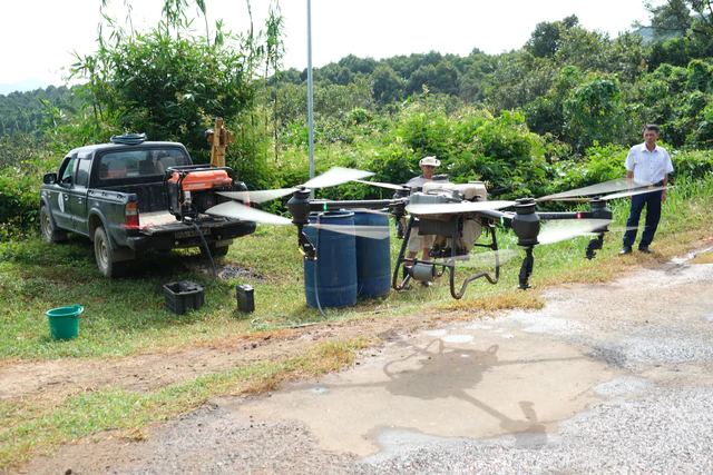
Drones used for spraying crops and applying fertilizer are common in agricultural areas around Lien Khuong Airport near Da Lat, including Duc Trong, Lam Ha, and Don Duong. Photo: M.V.
Drones are becoming increasingly common in Lam Dong for filming, photography, tourism, and agriculture.
Around Lien Khuong Airport, drones are widely used to spray crops and apply fertilizer in agricultural areas such as Duc Trong, Lam Ha, and Don Duong.
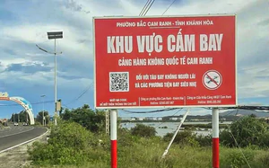
The provincial military command warned that flying into restricted zones or operating drones without registration or flight coordination could pose significant risks to aviation safety.
Kites, sky lanterns, laser lights, and fireworks can also endanger aircraft if used in inappropriate locations.
Van Giang - M.V. / Tuoi Tre News
Link nội dung: https://news.tuoitre.vn/no-drone-zones-near-airports-in-central-vietnam-mapped-on-google-earth-103261030144401945.htm