Ragasa intensifies, could reach super typhoon strength in 3 days
Storm Ragasa strengthened to level 11 (103-117 kph) with gusts up to level 14 (150-166 kph) early on Saturday morning and is forecast to intensify rapidly, possibly reaching super typhoon strength as it enters the East Vietnam Sea in the next three days, according to the country’s national weather agency.
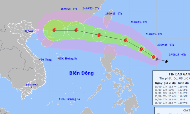
A map shows the projected locations and path of storm Ragasa at 7:00 am on September 20, 2025. Photo: Vietnam’s National Center for Hydro-Meteorological Forecasting
The National Center for Hydro-Meteorological Forecasting reported that at 7:00 am on Saturday, Ragasa’s center was located about 750 kilometers east of Luzon Island in the Philippines.
Maximum sustained winds near the storm’s eye reached 103-117 kph, with gusts up to 150-166 kph.
Over the next 24 hours, Ragasa is expected to move west-northwest at 10-15 kph and intensify further.
By 7:00 am on Sunday, it could be about 530 km east of Luzon with sustained winds at level 13 (134-149 kph) and gusts up to level 16 (184-201 kph).
Between Sunday and Monday, the storm will continue west-northwest, strengthening to level 15 (167-183 kph) with gusts above level 17 (202-220 kph), about 240 km northeast of Luzon.
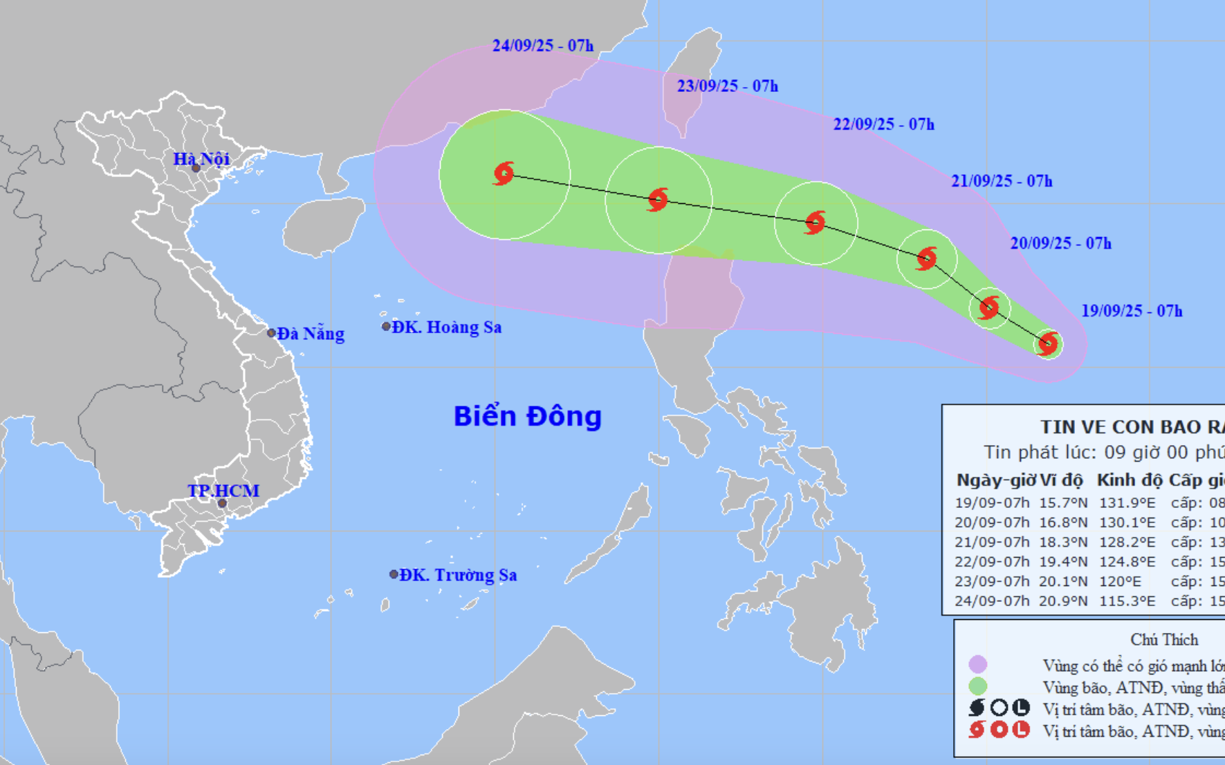
In the following 24 hours, Ragasa is projected to move faster at 20-25 kph, entering the East Vietnam Sea on Tuesday as the ninth storm of the year to hit this maritime region, maintaining intensity at levels 15-16 (167-201 kph) with destructive gusts.
From Monday afternoon, strong winds of levels 6-7 (39-61 kph), later increasing to levels 8-9 (62-88 kph) with gusts up to level 11, will possibly affect the northeastern East Vietnam Sea.
By Monday night, winds are forecast to reach levels 10-13 (89-149 kph), with areas near the storm’s center experiencing levels 14-16 (150-201 kph) and gusts above level 17.
Waves could reach 4-8 meters, rising over 10 meters near the eye, creating extremely dangerous conditions for vessels.
Meanwhile, storm Mitag, the eighth storm to affect the East Vietnam Sea this year, weakened into a tropical depression early on Saturday morning over southern Guangdong Province, China. Sustained winds dropped to level 6 (39-49 kph), with gusts at level 8 (62-74 kph).
Mitag is expected to continue weakening inland and poses no further threat to Vietnam.
Minh Duy - Chi Tue / Tuoi Tre News
Link nội dung: https://news.tuoitre.vn/ragasa-intensifies-could-reach-super-typhoon-strength-in-3-days-103250920102205092.htm