
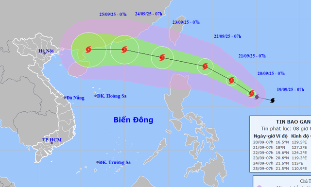
A map shows the projected locations and path of storm Ragasa at 7:00 am on September 20, 2025. Photo: Vietnam’s National Center for Hydro-Meteorological Forecasting
The National Center for Hydro-Meteorological Forecasting reported that at 7:00 am on Saturday, Ragasa’s center was located about 750 kilometers east of Luzon Island in the Philippines.
Maximum sustained winds near the storm’s eye reached 103-117 kph, with gusts up to 150-166 kph.
Over the next 24 hours, Ragasa is expected to move west-northwest at 10-15 kph and intensify further.
By 7:00 am on Sunday, it could be about 530 km east of Luzon with sustained winds at level 13 (134-149 kph) and gusts up to level 16 (184-201 kph).
Between Sunday and Monday, the storm will continue west-northwest, strengthening to level 15 (167-183 kph) with gusts above level 17 (202-220 kph), about 240 km northeast of Luzon.
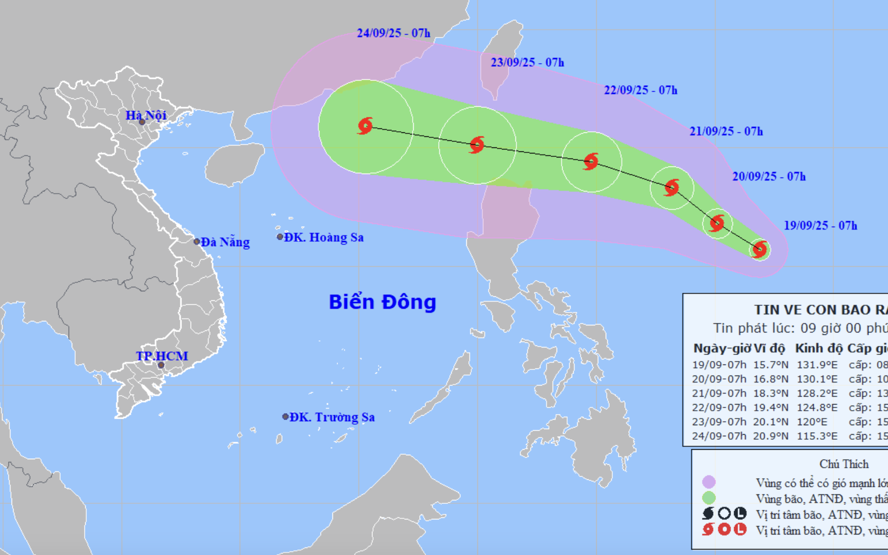
In the following 24 hours, Ragasa is projected to move faster at 20-25 kph, entering the East Vietnam Sea on Tuesday as the ninth storm of the year to hit this maritime region, maintaining intensity at levels 15-16 (167-201 kph) with destructive gusts.
From Monday afternoon, strong winds of levels 6-7 (39-61 kph), later increasing to levels 8-9 (62-88 kph) with gusts up to level 11, will possibly affect the northeastern East Vietnam Sea.
By Monday night, winds are forecast to reach levels 10-13 (89-149 kph), with areas near the storm’s center experiencing levels 14-16 (150-201 kph) and gusts above level 17.
Waves could reach 4-8 meters, rising over 10 meters near the eye, creating extremely dangerous conditions for vessels.
Meanwhile, storm Mitag, the eighth storm to affect the East Vietnam Sea this year, weakened into a tropical depression early on Saturday morning over southern Guangdong Province, China. Sustained winds dropped to level 6 (39-49 kph), with gusts at level 8 (62-74 kph).
Mitag is expected to continue weakening inland and poses no further threat to Vietnam.

Max: 1500 characters
There are no comments yet. Be the first to comment.