
Running data reveals hidden trail on Lang Biang peak in Vietnam’s Central Highlands
A new trekking route through the Lang Biang Biosphere Reserve has been discovered by Da Lat enthusiasts using route data from Lamdong Trail 2026, an official race organized by the Lam Dong Provincial People’s Committee. The trail offers hikers a chance to explore the reserve during its most scenic seasons.
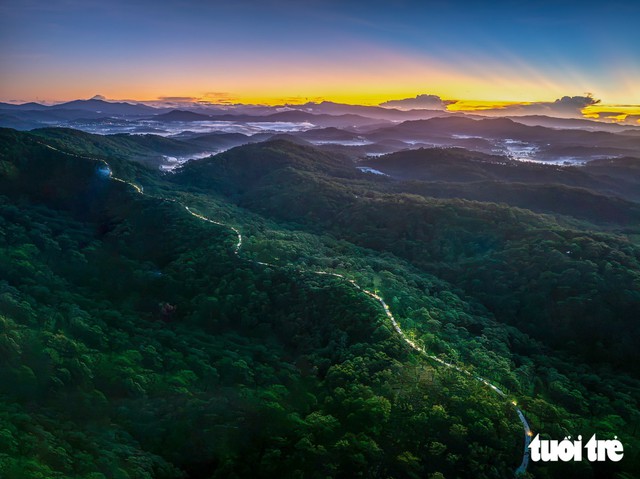
The forest trail featured in Lamdong Trail 2026 offers elevated views of the vast Lang Biang forest and its sea of clouds. Photo: Thu Thao / Tuoi Tre
Trekking is popular in Da Lat, attracting nature lovers keen to explore the scenic landscapes of the Central Highlands, particularly the Lang Biang area.
The route in question is the 85-kilometer course of Lamdong Trail 2026, which starts at the Valley of Love or a nearby forest area before winding deep into the Lang Biang Biosphere Reserve.
For runners, it is the longest distance in the race. For hikers, however, the route offers a series of trails that can be explored over several days in Da Lat.
The first section, around kilometers 15 to 20, climbs toward the summit of Lang Biang, an ideal spot to catch the sunrise.
On clear mornings, a sea of clouds spreads below, enveloping Da Lat. Visitors hoping to catch the view should set out early, bring warm clothing and a flashlight, and walk carefully through the mist-covered pine forest.
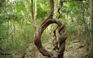
Between kilometers 35 and 45, the route passes through the ancient forests of Bidoup. The air is cool and the canopy dense, but the trail can be slippery and difficult to navigate.
This section is better suited to experienced hikers or groups accompanied by a local guide. Visitors should proceed carefully and avoid hiking alone.
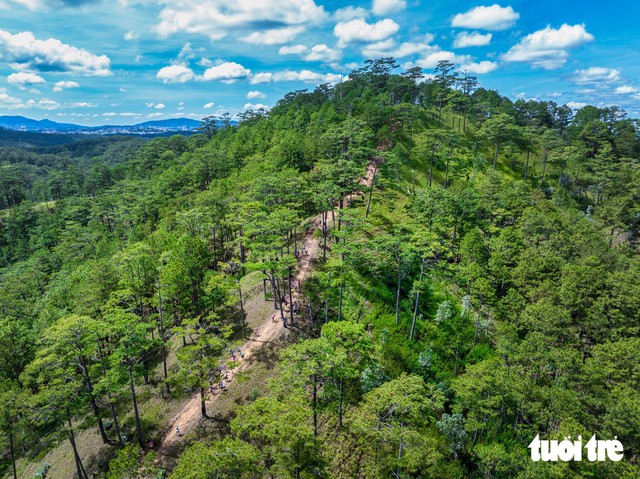
A trekking trail winds through an open pine forest in the Lang Biang Biosphere Reserve. Photo: Thu Thao / Tuoi Tre
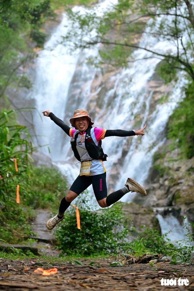
Tam Tham Waterfall, hidden deep in the forest, offers a scenic stop for trekking and photography enthusiasts. Photo: Thu Thao
Beyond Bidoup, the trail becomes gentler. Between kilometers 55 and 65, it winds across Da Sar Hill, through lush forests and past small streams, some of which hikers must wade through.
This stretch offers a chance to take a break, splash cool stream water on their faces and enjoy a light snack.
The race's 55-kilometer and 85-kilometer routes also pass Tam Tham Waterfall, or Hidden Waterfall, deep in the forest, making it a worthwhile stop for those who enjoy photography.
The final kilometers cut through pine forests, with afternoon sunlight filtering through the canopy. Toward the end of the year, wild sunflowers bloom along the red-dirt trail, lining the way in golden yellow for the final stretch.

Several participants who previously took part in the race said they planned to return for a leisurely run or hike, giving themselves more time to experience the unique forest landscape of the Lam Vien Plateau. Photo: Thu Thao
Hoang Thu Hong said that trekking through Lang Biang offers visitors a chance to experience both temperate and tropical forests, with the landscape changing depending on altitude.
She added that the sight of maple trees changing color along the way was particularly beautiful.
The entire route lies within the Lang Biang Biosphere Reserve. While some sections have been developed for tourism, others remain little more than trails winding through the forest.
Nguyen Hoang Nam, a hiking enthusiast who has taken part in trail-running races through Bidoup Forest, recommended that hikers travel in groups and choose days with favorable weather.
"If you want to hike through the forest, you should go in a group when the weather is good. Most importantly, you should notify the forest management board in advance so they can monitor your safety," he said.
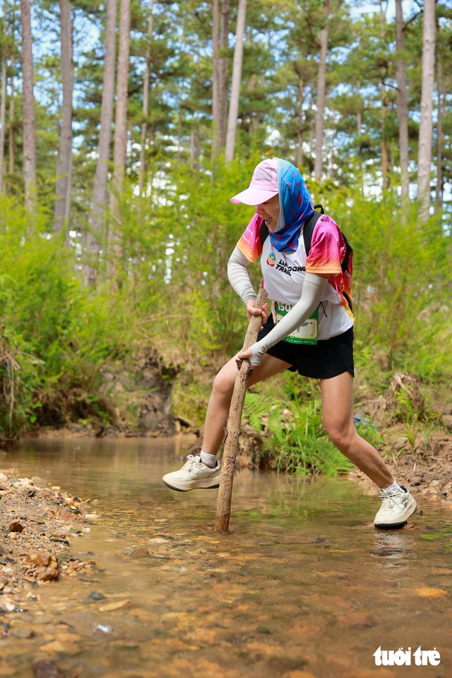
A section of the trail requires hikers to wade through a stream in the pine forest. Photo: Thu Thao
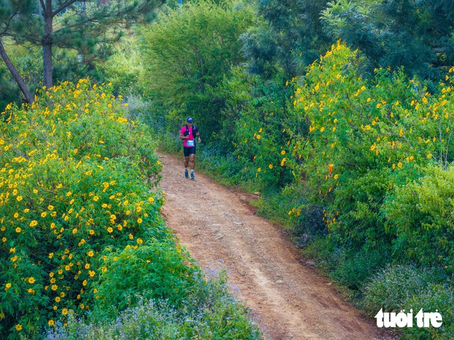
Wild sunflowers bloom along sections of the forest trail in early November each year, weather permitting. Photo: Thu Thao

Van Giang - M.V. / Tuoi Tre News
Link nội dung: https://news.tuoitre.vn/running-data-reveals-hidden-trail-on-lang-biang-peak-in-vietnams-central-highlands-103261110165934223.htm