
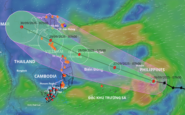
A satellite image shows storm Bualoi's projected path as recorded at 7:00 am on September 26, 2025. Photo: Vietnam Disaster Monitoring System
The National Center for Hydro-Meteorological Forecasting reported that as of 9:00 am on Friday, Bualoi's eye was located over the central Philippines, packing winds at level 11 (103-117 kph) with gusts reaching level 14 (150-166 kph).
By Friday night, the storm is forecast to enter the East Vietnam Sea, becoming the 10th storm of 2025 to affect the maritime region.
Tracking west-northwest at 30 kph, Bualoi is expected to pass west of Vietnam's Hoang Sa (Paracel) Special Zone around Sunday, with winds intensifying to level 13 (134-149 kph), gusting to level 15 (167-183 kph).
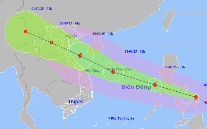
It is then projected to shift direction, heading toward Vietnam's north-central coast and southern parts of the Red River Delta.
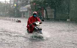
Direct impacts are anticipated by Monday, with widespread heavy rainfall forecast from Thanh Hoa Province to Hue City, and across northern Vietnam.
In response, the Ministry of Agriculture and Environment has instructed the coastal provinces from Quang Ninh to An Giang to issue vessel warnings and prepare evacuation and rescue plans.
The Department of Dyke Management and Natural Disaster Prevention and Control warned of high risks to fishing vessels, coastal communities, and inland areas vulnerable to flooding due to Bualoi's large circulation.
Authorities also urged residents to remain vigilant in the aftermath of super typhoon Ragasa and advised people to call the 112 emergency hotline for disaster assistance if needed.
Super typhoon Ragasa, the strongest storm ever recorded in the East Vietnam Sea, moved into the maritime region on Monday night.
Ragasa weakened to the typhoon level on Wednesday morning before being downgraded to a tropical depression and then a low-pressure zone upon its landfall in Quang Ninh Province, northern Vietnam on Thursday.

Max: 1500 characters
There are no comments yet. Be the first to comment.