
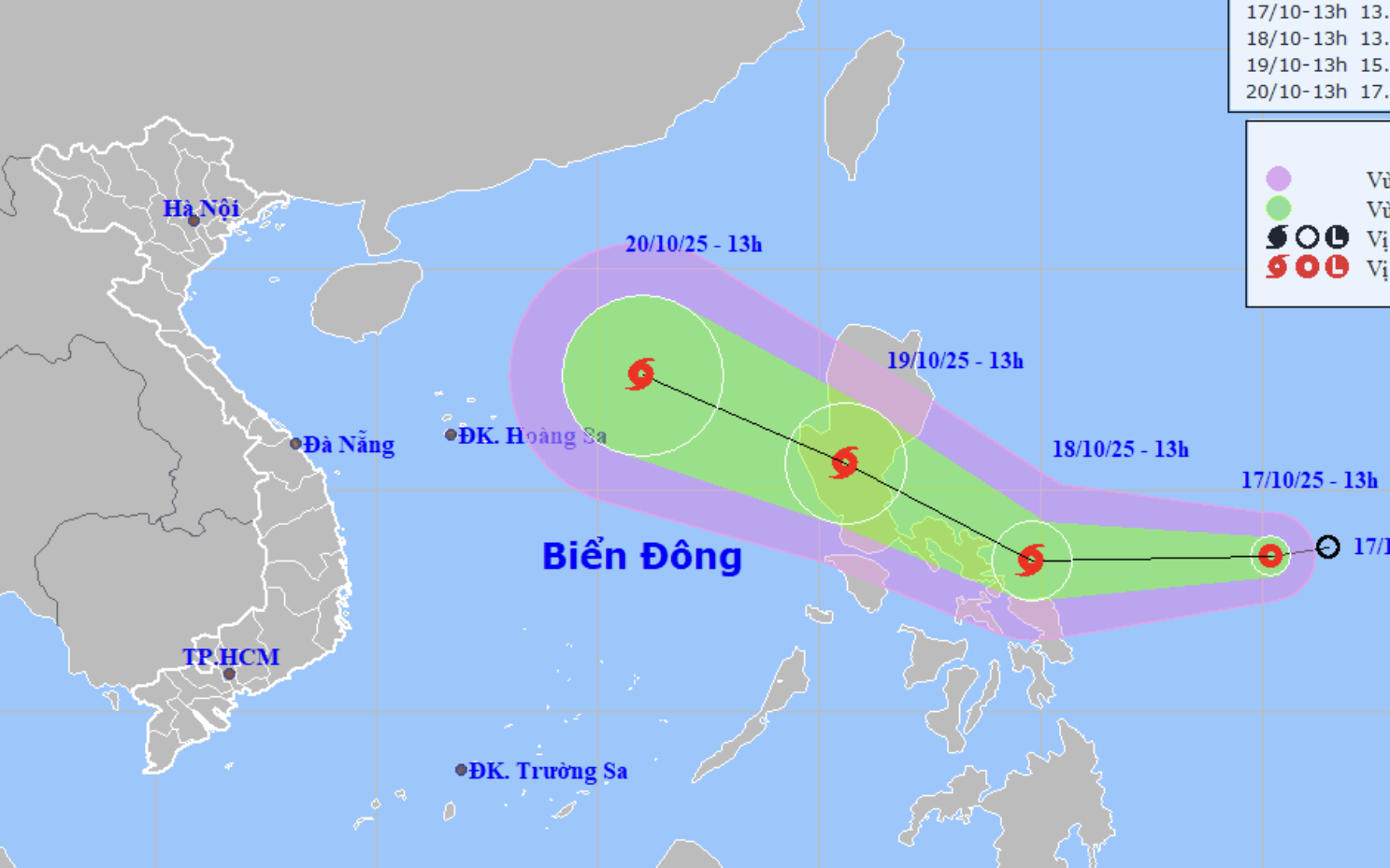
A map shows the projected path of storm Fengshen, as recorded at 7:00 am on October 18, 2025. Photo: Vietnam’s National Center for Hydro-Meteorological Forecasting
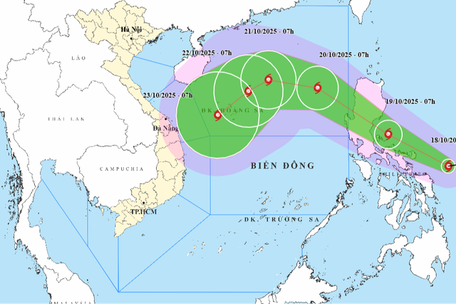
The National Center for Hydro-Meteorological Forecasting reported that at 7:00 am on Saturday, Fengshen’s center was located over the eastern waters of the central Philippines, packing maximum sustained winds of 62-74 kph, with gusts up to 89-102 kph.
The storm was moving westward at about 20 kph and is expected to gain strength in the coming hours.
From Sunday, strong winds will possibly begin to affect the northeastern part of the East Vietnam Sea, where winds may reach 39-88 kph, gusting up to 103-117 kph, with waves of 2.5-5 meters, causing very rough seas.
Between Monday and Wednesday next week, the northern part of the East Vietnam Sea, including Vietnam’s Hoang Sa (Paracel) Special Zone, could experience winds of 89-117 kph, with gusts up to 134-149 kph.
Vessels operating in these areas are warned of thunderstorms, strong winds, and large waves.
The national weather agency noted that after entering the East Vietnam Sea, Fengshen may initially move northwest but could then shift sharply southward, making its track zigzag and unpredictable.
The agency attributed the shift to the arrival of a northeast monsoon, which may alter the storm’s trajectory and weaken its intensity.
However, forecasters cautioned that the interaction between the cold air mass and the storm could create complex and extreme weather conditions, urging residents and seafarers to stay updated on official weather bulletins.

Max: 1500 characters
There are no comments yet. Be the first to comment.