
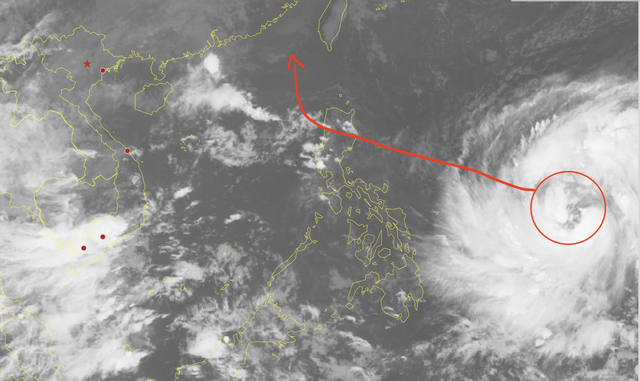
A satellite image shows the forecasted track and position of storm Fung Wong, which is expected to enter the East Vietnam Sea around November 10-11, 2025. Photo: Vietnam’s National Center for Hydro-Meteorological Forecasting
Nguyen Van Huong, head of the weather forecasting division at the National Center for Hydro-Meteorological Forecasting, said on Friday that Fung Wong, currently active east of the Philippines, was named by Hong Kong after a mountain there.
As of Friday morning, Fung Wong was packing winds of 103-117 kph and was located about 1,800 kilometers east-southeast of Luzon Island and roughly 2,100 kilometers from the East Vietnam Sea.
Over the next two to three days, the storm is expected to move west-northwest toward Luzon and the northeastern part of the East Vietnam Sea, strengthening further before making landfall in the Philippines.


Forecasters estimate its intensity could reach 150-183 kph, similar to that of storm Kalmaegi, which battered Vietnam’s Central Highlands and south-central provinces late on Thursday.
Around the night of November 10 or the morning of November 11, Fung Wong could move into the northeastern East Vietnam Sea, becoming the 14th storm in the area this year.
“Preliminary analysis suggests a low probability of the storm making landfall in Vietnam,” Huong said, noting that atmospheric patterns remain unstable and that meteorologists will continue to issue updates and warnings.
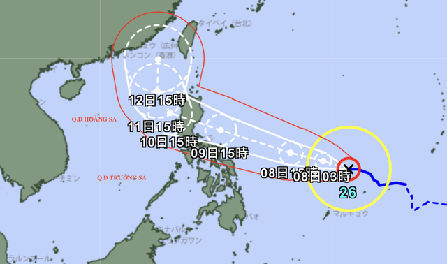
A map shows the predicted path of storm Fung Wong. Photo: Japan Meteorological Agency
The Japan Meteorological Agency reported similar forecasts, estimating wind speeds of up to 50 meters per second before landfall in the Philippines, with gusts reaching 70 meters per second. Upon entering the East Vietnam Sea, the storm is expected to weaken slightly to 35 meters per second, with gusts of 50 meters per second.
The Hong Kong Observatory also predicted that Fung Wong could briefly reach super typhoon strength, with winds near 195 kph before weakening over the sea.


Max: 1500 characters
There are no comments yet. Be the first to comment.