
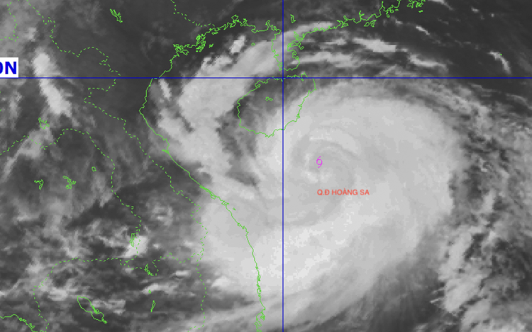
Satellite imagery at 7:00 am, August 24, 2025 shows a broad storm circulation. Photo: Vietnam’s National Center for Hydro-Meteorological Forecasting
The storm is expected to bring torrential rain, posing a high risk of flooding and landslides in many areas.
Mai Van Khiem, director of the national weather center, said on Sunday morning that the storm had intensified significantly, with strong winds at level 12 (118–133 kph) and gusts as high as level 15 (167-183 kph).
The storm was located some 600 kilometers east-southeast of the Nghe An-Ha Tinh coastline, he said.
Its strength may increase further in the next 12-24 hours, potentially reaching level 14 (150-166 kph), with gusts up to level 16.
Several meteorological factors are contributing to the storm’s rapid intensification, Khiem said.
Kajiki is developing over a warm sea surface with temperatures above 30 degrees Celsius – an ideal condition for a storm to draw energy and grow stronger.
Additionally, the storm is situated within an active intertropical convergence zone, where easterly and southwesterly winds converge, generating both thermal and dynamic forces that enhance storm development.
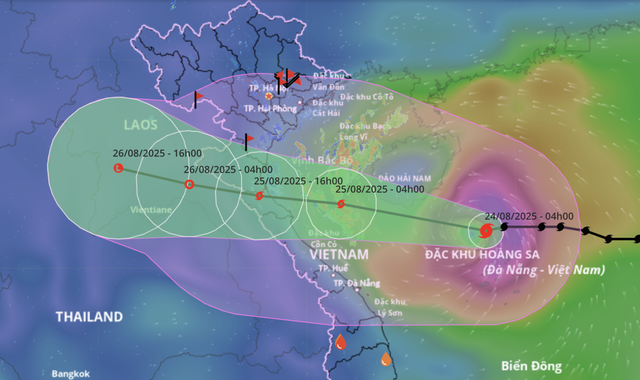
A map shows the projected locations and path of storm Kijiki, the fifth storm to hit the East Vietnam Sea in 2025, as of 4:00 am on August 24, 2025. Photo: Vietnam’s National Center for Hydro-Meteorological Forecasting
Starting late tonight, the coastal provinces from Thanh Hoa to Quang Tri might begin experiencing strengthening winds as the storm approaches, he said.
When Kajiki makes landfall on Monday, it is expected to unleash a combination of destructive forces.
At sea, wind speeds could reach levels 12-13, with gusts up to level 16, while waves are forecast to rise between five and seven meters, and possibly up to nine meters near the storm’s center.
These conditions pose an extreme hazard to all maritime activities, including large cargo vessels and offshore fishing operations.
Besides, coastal and inland areas could experience winds of level 11-12, with gusts up to level 15, threatening homes and infrastructure.
The storm’s wide circulation is expected to trigger widespread rainfall across the north-central and northern regions.
Several localities may receive up to 600-700 millimeters of rain, increasing the risk of flash floods, severe inundation, and landslides in mountainous and low-lying areas.
Khiem urged the public not to underestimate the storm's potential.
He warned of thunderstorms and strong gusts, as well as the prolonged rainfall before, during, and after landfall, which could compound damage.

Max: 1500 characters
There are no comments yet. Be the first to comment.