
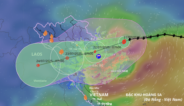
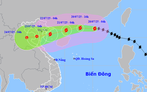
A map shows the projected locations and path of storm Wipha, the third storm to hit the East Vietnam Sea in 2025, as of 7:00 am on July 21, 2025. Photo: Vietnam’s National Center for Hydro-Meteorological Forecasting
As of 7:00 am, Wipha’s maximum sustained winds near the center were at level 9 (75-88 kph) on the Beaufort scale, gusting up to level 11 (103-117 kph).
The system was traveling west-southwest at 15-20 kph.
Compared to 7:00 pm the previous day, its intensity had dropped two levels after making landfall in China’s Guangdong Province.
However, forecasters expect the storm to strengthen again as it enters the Gulf.
Over the next 24 hours, Wipha is forecast to move west-southwest at 10-15 kph, reaching the northern part of the Gulf of Tonkin, with wind speeds of level 10-11 (89-117 kph), gusting to level 14 (150-166 kph).
It will then head toward Vietnam's northern coast, expected to make landfall between Hai Phong City and Thanh Hoa Province before weakening into a tropical depression.
By 7:00 am on Wednesday, the center of the tropical depression is forecast to be over Thanh Hoa-Nghe An, with sustained winds at level 6 (39-49 kph), gusting to level 8 (62-74 kph), before dissipating over northern Laos.

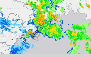
Fishing boats are anchored to shelter from storm Wipha, the third to enter the East Vietnam Sea in 2025, in Van Don Special Zone, Quang Ninh Province, northern Vietnam. Photo: V.Don
Severe marine conditions expected
As Wipha approaches, strong winds of level 7-8 (50-74 kph) and gusts up to level 10 (89-102 kph) are forecast in the northwestern part of the East Vietnam Sea, with wave heights possibly reaching 3-5 meters.
In the northern Gulf of Tonkin, covering Bach Long Vi, Co To, Cat Hai, and Hon Dau Islands, winds will likely increase to level 10-11 (89-117 kph) near the storm center, gusting to level 14 (150-166 kph).

The southern Gulf of Tonkin, including Hon Ngu Island, could experience winds of level 8-9 (62-88 kph), with waves as high as four meters.
The coastal waters from Quang Ninh to Nghe An Provinces will see a gradual increase in wind speed from Monday evening.
Storm surge warnings have been issued for the coastal areas from Hai Phong to Quang Ninh, creating a high risk of flooding in low-lying coastal areas by Tuesday afternoon.
Widespread rainfall, flooding risk
Heavy rain is expected across northern Vietnam from Monday to Wednesday.
Rainfall totals could reach 200-350mm in the northeast, Red River Delta, Thanh Hoa Province, and Nghe An Province, potentially exceeding 600mm in some areas.
Other regions in the north and north-central Ha Tinh Province may see 100-200mm of rain, with localized areas experiencing over 300mm.
The National Center for Hydro-Meteorological Forecasting also highlights a high risk of flash floods and landslides in mountainous areas, as well as urban flooding in low-lying zones.
Authorities have warned of dangerous weather conditions on land and sea, advising all vessels and coastal infrastructure, including aquaculture farms, dikes, and ports, to halt operations.

Max: 1500 characters
There are no comments yet. Be the first to comment.