
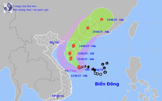
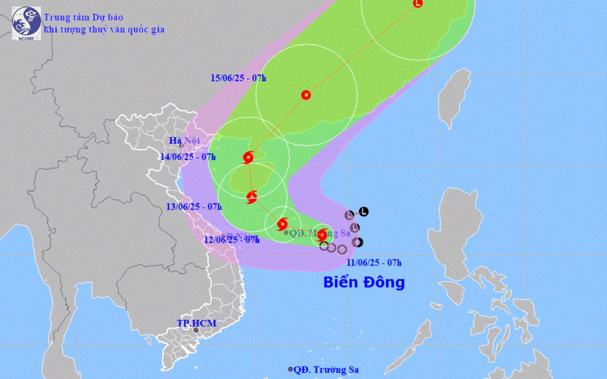
A map shows the projected locations and path of storm Wutip in the East Vietnam Sea as of 4:00 am on June 12, 2025. Photo: National Center for Hydro-Meteorological Forecasting
As of 4:00 am on Thursday, the storm's center was located west of Vietnam's Hoang Sa (Paracel) archipelago, with sustained winds of 62–88 kilometers per hour, the National Center for Hydro-Meteorological Forecasting reported.
Its circulation has already triggered widespread downpours and thunderstorms across central Vietnam and parts of the Central Highlands since Wednesday evening.
Rainfall reached 366 millimeters in Bach Ma in Hue City, 333 millimeters in Hoa Hiep Bac in Da Nang City, and 240 millimeters in Tan Hiep in Quang Nam Province.
Wutip is forecast to continue moving northwest at about 10 kilometers per hour and may strengthen further.
By early Friday, it is expected to reach the southern coast of China's Hainan Island.
From there, the storm is projected to head toward China's Leizhou Peninsula and move inland on Saturday, weakening to a tropical depression after crossing the Gulf of Tonkin.
As Wutip advances, dangerous sea conditions are expected in the western part of the East Vietnam Sea, including the Hoang Sa area, with wind speeds of 89-102 kilometers per hour and gusts up to 149 kilometers per hour.
Waves could reach 4-6 meters in height.
The Gulf of Tonkin may also see rising wind speeds starting Thursday night, with sustained winds of 39–61 kilometers per hour and gusts up to 117 kilometers per hour.
Rainfall is expected to remain heavy through Friday in central provinces, with widespread totals of 100–200 millimeters and localized areas receiving more than 350 millimeters.
Ha Tinh Province and the northern Central Highlands may see 30–80 millimeters of rain, with some areas exceeding 150 millimeters.
Authorities have warned of potential flash floods and landslides in mountainous areas, as well as urban flooding in low-lying or industrial zones, especially where rainfall exceeds 200 millimeters in just six hours.
Residents are advised to follow official weather updates closely, as the storm's trajectory and intensity may still shift.

Max: 1500 characters
There are no comments yet. Be the first to comment.