
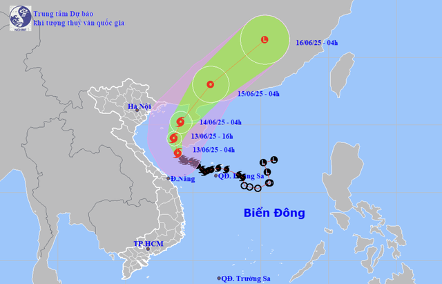
A map shows the projected locations and path of storm Wutip in the East Vietnam Sea as of 4:00 am on June 13, 2025. Photo: National Center for Hydro-Meteorological Forecasting
As of 4:00 am, Wutip's center was located just south of Hainan Island, according to the National Center for Hydro-Meteorological Forecasting.
The storm has strengthened from level 9 (75-88 kph) to level 10 (88-102 kph) on the Beaufort scale, with gusts reaching up to level 13 (134-149 kph).
Forecasters say the storm is moving north-northwest and is likely to hit Hainan's western coast by late Friday afternoon.
It is expected to maintain its intensity through the evening before shifting direction toward the northeast, skirting along the island's coast and heading toward China's Leizhou Peninsula.
By 4:00 am on Saturday, Wutip's center is projected to reach the northeastern Gulf of Tonkin, still at level 9-10 strength, before weakening into a tropical depression over southern Guangdong Province.
Strong winds and high waves are battering the northwestern part of the East Vietnam Sea.
Offshore zones from Quang Tri to Quang Nam are experiencing wind speeds of level 6-8 (39-74 kph), increasing to level 9-10 closer to the storm's center, with gusts up to level 13.
Waves in affected areas are reaching heights of 4-6 meters.
In the Gulf of Tonkin, winds are also intensifying, ranging from level 6-7 (39-61 kph) and reaching level 8-10 (62-102 kph) near the storm's core.
Authorities warn that coastal flooding could occur in low-lying areas from Hai Phong to Nghe An during high tides between 5:00 pm and 7:00 pm on both Friday and Saturday.
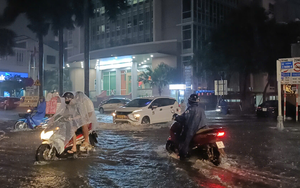
Central Vietnam remains under threat of continued heavy rainfall.
Between Quang Binh Province and Hue City, rainfall totals have reached 50-130 mm, with some areas recording more than 250 mm.
Further rain is expected in Nghe An, Ha Tinh, Da Nang, Quang Nam, and Kon Tum.

A helicopter and a rescue team of the Vietnam People's Air Force take part in a rescue drill. Photo: Phong khong - Khong quan (Air Defense - Air Force) newspaper
Military on full alert for Wutip
Vietnam's military has mobilized a significant response force to brace for the storm's impact.
More than 264,600 personnel, seven aircraft, 428 specialized vehicles, and over 1,400 boats and speedboats are on standby.
Border guards from Quang Ninh to Phu Yen have helped alert over 53,000 vessels carrying approximately 223,000 people.
Many of these boats have moved to sheltered waters or are now docked at ports.
Phung Tien Dung, head of the Hydrological Forecasting Department, said rainfall from Ha Tinh to Hue could reach 100-180 mm on Friday, with some locations expected to exceed 350 mm.
Authorities continue to monitor the storm closely, urging residents to stay informed and prepared for potential flash floods and landslides.

Max: 1500 characters
There are no comments yet. Be the first to comment.