
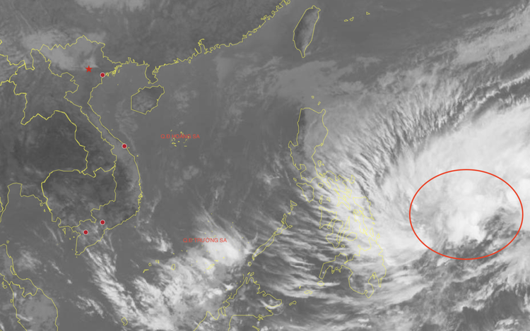
A map shows a tropical depression over the waters of the Philippines. Photo: National Center for Hydro-Meteorological Forecasting
The tropical depression east of the Philippines is currently packing maximum sustained winds of level 7 (50-61 kph), with gusts reaching level 9 (75-88 kph).
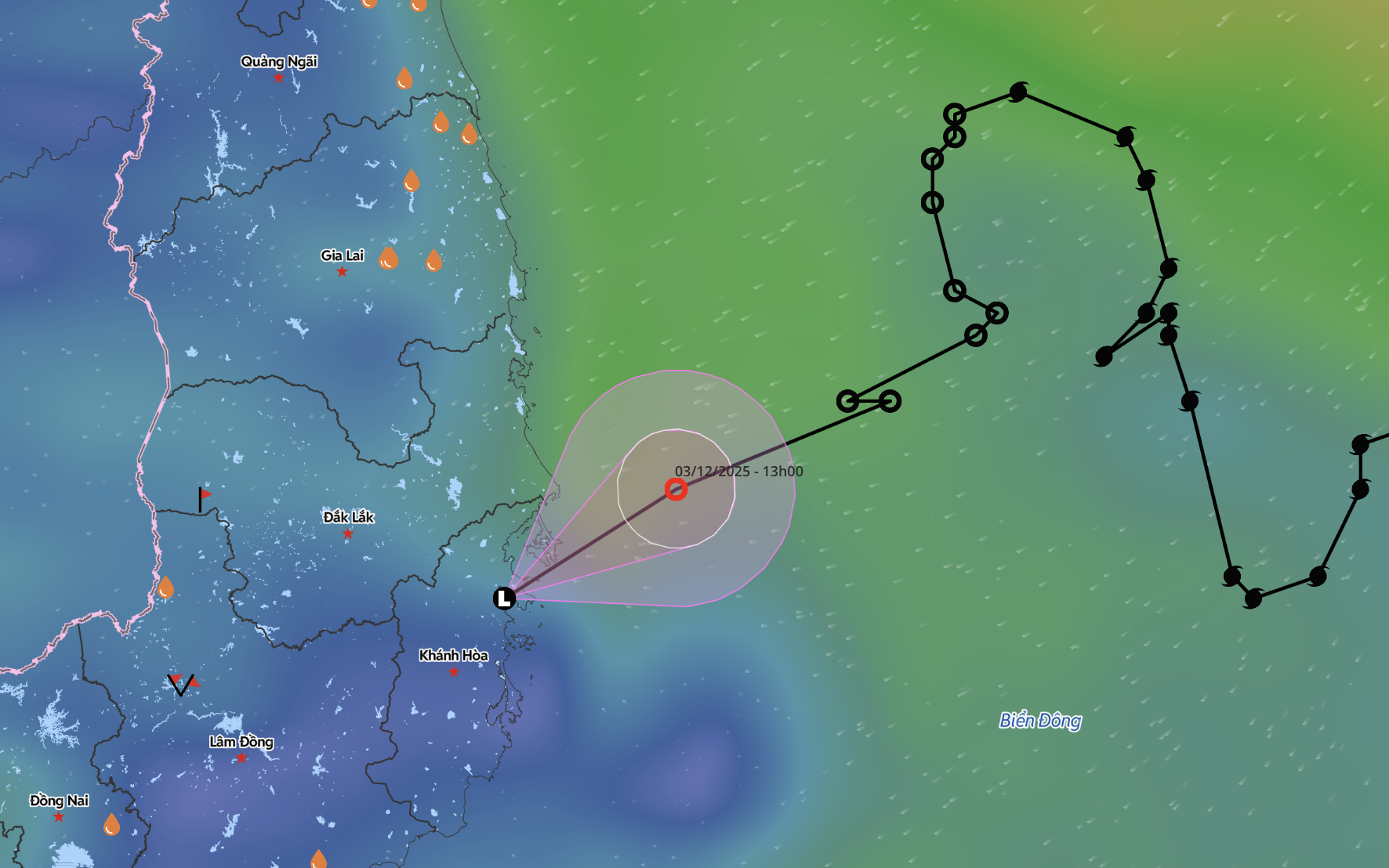
Over the next 24 hours, the system is expected to move west-northwestward and may strengthen into a storm.
If it does strengthen, it would become the first storm to hit the northwestern Pacific in 2026.
After intensification, the storm is forecast to turn northward, tracking mainly along the waters east of the Philippines.
A strong cold air mass is currently dominating the East Vietnam Sea, significantly reducing the likelihood of the system moving into Vietnamese waters.
The storm is instead expected to weaken and dissipate over the northeastern waters of the Philippines on January 19 or 20.
From now until March, the East Vietnam Sea is unlikely to see the formation of storms or tropical depressions, forecasters said.
Between April and June this year, storm and tropical depression activity over the East Vietnam Sea is projected to be near the long-term average.
However, the likelihood of storms making landfall in Vietnam during this period remains low.
Data showed that from April to June each year, an average of about 1.8 systems are active over the East Vietnam Sea, with only around 0.3 making landfall in Vietnam.
Mai Van Khiem, director of the National Center for Hydro-Meteorological Forecasting, said La Niña is currently weakening at a relatively fast pace.
He forecast that 2026 is likely to be a typical ENSO transition year, with conditions shifting to ENSO-neutral between January and May at a probability of 75-85 percent.
By mid-year, ENSO-neutral conditions are expected to remain dominant, although sea surface temperatures are projected to rise.
In the second half of the year, the probability of El Niño emerging is forecast to rise to around 55-65 percent.
If El Niño does develop, it is likely to be weak to moderate in strength, similar to events observed in 1996, 2009, 2014, and 2018.
Under this ENSO scenario, Khiem said storm and tropical depression activity in 2026 may be limited in number, but their intensity and tracks could be difficult to predict, particularly in the latter half of the season as conditions shift from neutral toward a warmer phase.
ENSO, or El Niño-Southern Oscillation, refers to fluctuations between El Niño and La Niña phases.
El Niño years typically bring prolonged heat and drought, delayed rainy seasons, reduced flood, and storm activity.
In contrast, La Niña events are associated with strong and persistent monsoon winds, abundant rainfall, and more frequent storms and tropical depressions.

Max: 1500 characters
There are no comments yet. Be the first to comment.