


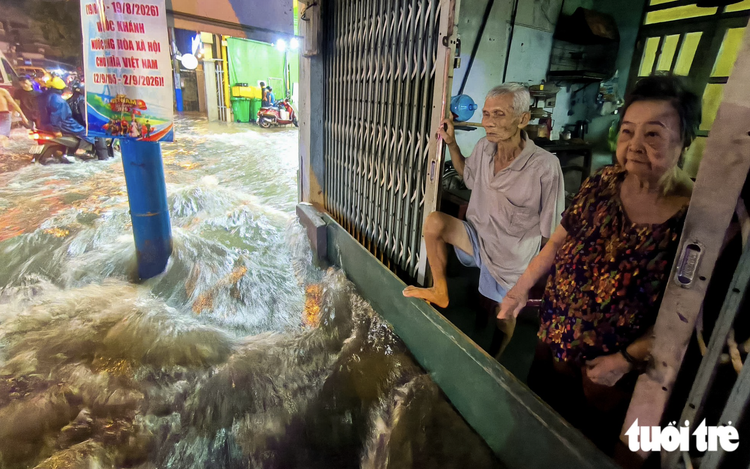
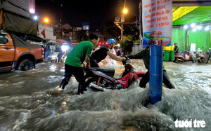
Flooding accompanied by strong currents on Ly Te Xuyen Street in Hiep Binh Ward, Ho Chi Minh City. Photo: Chau Tuan / Tuoi Tre
The municipal Department of Construction told a socio-economic press briefing on Thursday that the affected locations have flooded in previous years, but some streets are now seeing greater flood depths and longer periods of inundation and drainage.
The city’s drainage system was designed to cope with rainfall of 85.3 mm over three hours and a high tide level of +1.32 m, said Pham Quoc Huy, deputy head of the department’s technical infrastructure division.
However, several rain gauges recorded more than 100 mm of rainfall within just 45 minutes to one hour on September 30 and October 1.
The widespread and prolonged rain also pushed up water levels in rivers, canals and drainage channels, reducing the system’s ability to discharge floodwater.
At the same time, high tides were reported in the city from September 28 to October 1.
These conditions created a combination that made flooding both deeper and slower to recede.
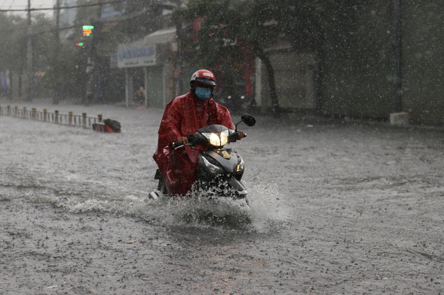
Nguyen Van Khoi Street in Ho Chi Minh City flooded after downpours. Photo: Le Phan / Tuoi Tre
Construction projects add to drainage problems
Heavy rain and high tides are not the only factors.
The department also attributed slower drainage to several infrastructure projects.
Among them are the rehabilitation of the Tham Luong-Ben Cat-Nuoc Len canal system and the drainage improvement project along Le Van Tho and Nguyen Van Khoi Streets.
The city’s drainage network was built over many years, and some parts have urbanized much faster than the supporting infrastructure.
In several rapidly developed areas, side streets and alleys still lack drainage pipes or have undersized systems.
Increasing concrete coverage and land subsidence have also reduced the city’s ability to retain and drain rainwater.
In some residential areas and new urban developments, infrastructure has not yet been handed over to management agencies in a timely manner.
Drainage operations in some communes and wards remain inconsistent, while certain catch basins have been blocked.
In some locations, downstream connecting pipes are higher than the main drainage pipes, further impeding the flow of water.
According to the department, these shortcomings have contributed to prolonged flooding on streets including Cong Nghe Moi and Ma Lo.
Flooding has worsened on such streets as Phan Huy Ich, Quoc Huong and Nguyen Van Huong.
Nguyen Van Khoi project stalled over water pipes
One example of how infrastructure constraints can prolong flooding is the drainage improvement project on Nguyen Van Khoi and Le Van Tho Streets around Lang Hoa Park.
The project has been suspended since May, after reaching about 33 percent completion, because existing water supply pipes lie within the project area.
Whenever heavy rain falls, Nguyen Van Khoi Street and surrounding areas are flooded, disrupting travel, daily activities and local businesses.
During recent downpours, water rose deeply along Nguyen Van Khoi Street and quickly spilled into areas in front of houses.
Residents had to find ways to keep the water out, while businesses suffered as customers avoided the flooded area.
Phuong Thoa, who has lived along the street for years, said rain regularly sends water into her home.
“Even a mild rain can flood the street,” she said.
“Every rainy season, we have become used to this situation.
“I hope the project can be completed soon so life will be easier for local residents.”
The Ho Chi Minh City Urban Infrastructure Construction Investment Project Management Board told Tuoi Tre (Youth) online newspaper that the drainage improvement project on Nguyen Van Khoi and Le Van Tho began on June 16 last year.
Construction had reached some 33 percent of the contract value.
However, work was suspended in May as an existing water supply system, extending about 2.3 kilometers, runs through the project area and must be relocated.
Although some components have already been completed and connected, they cannot yet operate at full capacity.
Therefore, the area continues to experience flooding during heavy rain.
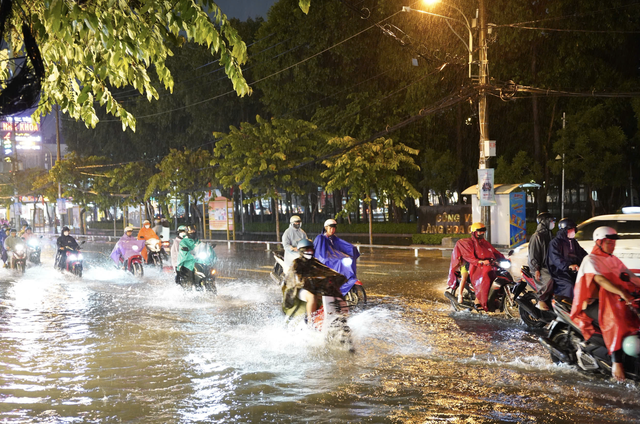
Motorcyclists travel on a flooded section of Nguyen Van Khoi Street. Photo: Cam Ly / Tuoi Tre
Immediate actions, long-term plans to ease flooding
Immediate measures will focus on maintaining and dredging drainage systems, removing obstructions and rapidly addressing blockages caused by construction, according to the department.
During heavy rain, response forces will increase monitoring, remove rubbish from catch basins, open manholes where necessary, deploy emergency pumps and regulate traffic at flooded locations.
In the longer term,the city plans to review the condition of its drainage network, identify the causes of flooding and establish investment priorities.
Bottlenecks in drainage pipes, canals and discharge outlets will be addressed.
Major projects, including tidal-control works, will continue to be implemented to increase the city’s drainage capacity.
The recent flooding highlights a broader problem facing Ho Chi Minh City: drainage infrastructure designed for earlier rainfall and urban conditions is increasingly being tested by intense downpours, high tides, rapid urbanization, land subsidence and construction-related disruptions.








Max: 1500 characters
There are no comments yet. Be the first to comment.