


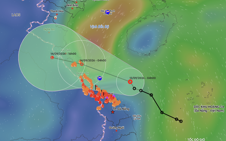
A map shows the projected position and track of a tropical depression in the East Vietnam Sea. Photo: The Vietnam Disaster Monitoring System
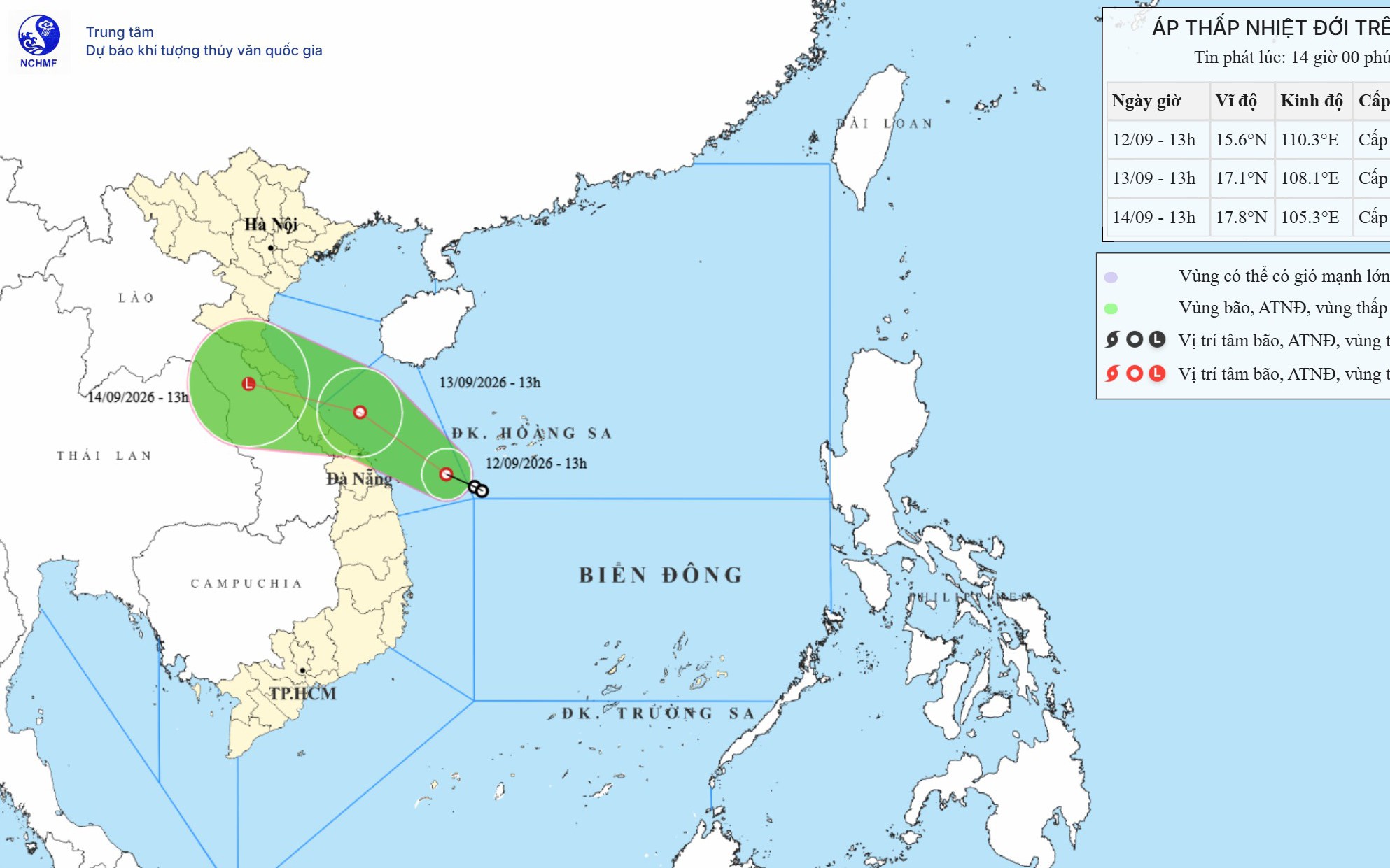
At 4:00 am on Sunday, the eye of the depression was over the Quang Tri-Da Nang sea area, about 160 kilometers east-northeast of Hue City.
Maximum sustained winds near the center reached level 6, or 39-49 kph, with gusts up to level 8.
Under the influence of the depression’s circulation, Con Co Special Zone in Quang Tri Province recorded level-6 winds with gusts reaching level 8.
The areas from Quang Tri to Da Nang experienced moderate to heavy rain on Saturday night and early on Sunday.
The depression is forecast to move west-northwest at about 10 kph on Sunday, tracking along the coast from Hue toward northern Quang Tri and Ha Tinh.
At 10:00 pm the same day, its center is expected to be over the coastal waters from Quang Tri to Ha Tinh, with winds remaining at level 6 and gusts up to level 8.
From Sunday night into the early morning of Monday, the depression is likely to move ashore in the area.
It is forecast to move farther inland and weaken into a low-pressure area during Monday.
The sea area from Ha Tinh to Da Nang is expected to see level-6 winds and gusts up to level 8 on Sunday.
Waves could reach 2-4 meters, producing rough seas.
Winds along the coast from Ha Tinh to Quang Tri are forecast to strengthen gradually to level 6, with gusts up to level 8 on Sunday afternoon.
The center has warned of thunderstorms, whirlwinds, and strong gusts associated with the depression’s circulation.
These conditions could strip roofs, damage temporary structures, uproot trees, and bring down advertising billboards, while disrupting power supplies, communications, and transportation.
Heavy rain spreading from central to northern Vietnam
The tropical depression is triggering a widespread spell of heavy rain across Thanh Hoa to Da Nang, and several localities in northern Vietnam.
From the morning through the night of Sunday, the areas from Ha Tinh to Hue are forecast to receive heavy to very heavy rain and thunderstorms, with rainfall generally ranging from 100 to 200 mm and locally exceeding 350 mm.
Thanh Hoa, Nghe An, and Da Nang might receive moderate to heavy rain and thunderstorms, with rainfall of 40-70 mm.
Some areas in the three localities are forecast to record precipitation of up to 150 mm.
Meanwhile, the northern midlands and delta, together with the southern parts of Son La and Phu Tho Provinces, are forecast to experience moderate to heavy rain and thunderstorms, with rainfall generally between 30 and 60 mm and locally above 100 mm on Sunday night.
On Monday, heavy to very heavy rain and thunderstorms are expected from Thanh Hoa to Quang Tri, with rainfall of up to 350 mm.
Many localities in northern Vietnam are forecast to receive 40-70 mm of rain, with some areas exceeding 150 mm.
The widespread spell of heavy rain is expected to continue through the morning of Wednesday.








Max: 1500 characters
There are no comments yet. Be the first to comment.