
Storm Fengshen is forecast to make landfall in central Vietnam on October 23, 2025. Photo: MVT
Due to the impact of the storm, downpours and strong winds have been battering several central provinces, according to the national weather center.
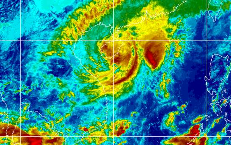
Fengshen was positioned over the northwestern waters of Vietnam's Hoang Sa (Paracel) Special Zone, packing sustained winds of level 10 (89-102 kph), with gusts reaching level 12, on Wednesday afternoon.
The storm moved westward at a speed of 5-10 kph.
By early Thursday morning, it is forecast to shift slightly southwest, moving at some 10 kph.
At that point, it will be around 100 kilometers east-northeast of Da Nang and is expected to gradually weaken.
In the northern part of the East Vietnam Sea, particularly around the Hoang Sa Special Zone, winds reached level 7-8, with areas near the storm’s center experiencing levels 9-10 and gusts up to level 12.
Waves rose between three and five meters, with the highest reaching seven meters, causing extremely rough seas.
The coastal waters from Quang Tri to Quang Ngai Provinces experienced severe conditions, with strong winds at levels 8-9 on Wednesday afternoon.
The weather center issued warnings for these coastal areas, including estuaries and low-lying sites, where a combination of strong waves and high tides could cause significant flooding.
All vessels, aquaculture operations, and maritime activities in the danger zones are at high risk of being affected by thunderstorms, strong winds, and rough waves.
On land, the storm’s circulation, in combination with a cold front, might bring strong winds at levels 8-9 to the provinces from Quang Tri to Da Nang City on Wednesday night.
Heavy rainfall and thunderstorms are forecast to continue hitting the provinces from Ha Tinh to Quang Ngai through Friday, due to the combined effects of the storm circulation, cold air, and eastern wind disturbances.
Precipitation is expected to range from 100 to 250 mm, with some areas exceeding 350 mm.
From southern Quang Tri to Da Nang, rainfall totals could reach 400-600 mm, with some areas likely to report a rain volume of 800 mm.
The heaviest rainfall is predicted to occur from Wednesday night through Thursday night.

Max: 1500 characters
There are no comments yet. Be the first to comment.