
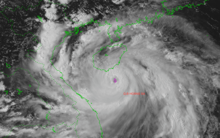
Satellite imagery of storm Kajiki at 3:00 pm, August 24, 2025. Photo: Vietnam’s National Center for Hydro-Meteorological Forecasting
Experts warned its potential impact could rival typhoon Yagi in 2024 and surpass the devastating storm Doksuri in 2017.
Typhoon Yagi, the third storm to hit Vietnam in 2024 and the most powerful to strike the East Vietnam Sea in the past three decades, claimed the lives of hundreds of people in early September last year.
Torrential rain triggered by Yagi flooded 20 provinces and cities in northern Vietnam.
As of September 17, the death toll from Yagi and the landslides and flash floods had risen to 329, while some 2,000 others had been injured.
The storm caused hundreds of thousands of houses, schools, and structures to collapse, damaging more than 307,000 hectares of rice, vegetables, and fruit cultivation, local media reported.
Hoang Phuc Lam, deputy director of the national weather center, said on Sunday afternoon that at 3:00 pm the same day, the eye of Kajiki was located some 460 kilometers east-southeast of Ha Tinh Province and about 400 kilometers east of northern Quang Tri Province.
“The storm is forecast to move west-northwest at a speed of around 20 km/h on Sunday evening and overnight, with potential for further strengthening,” Lam stated.
Some forecasts suggest it may reach level 15, though this is considered unlikely.
Between midday and late afternoon on Monday, the storm is expected to make landfall across provinces from Thanh Hoa to Quang Tri, with Nghe An, Ha Tinh, and former Quang Binh Province, now part of Quang Tri Province, anticipated to be the most heavily affected areas.

Hoang Phuc Lam, deputy director of the National Center for Hydro-Meteorological Forecasting. Photo: Chi Tue / Tuoi Tre
Widespread impact anticipated
Due to the storm's vast cloud system, rainfall has already begun in parts of northern Vietnam, including the capital Hanoi.
By this evening, wind conditions along the coastal waters from Thanh Hoa to Hue City, including Hon Ngu Island and the Con Co special zone, are expected to increase to level 7-9 (50-88 kph), later rising to level 10-11 (89-117 kph).
Areas near the storm’s center could experience strong winds at level 12-14 (118-166 kph), with gusts at level 16 (184-201 kph).
Sea waves are expected to reach heights of 5-7 meters, and up to 10 meters near the storm’s eye.
Starting from tonight, the coastal provinces from Thanh Hoa to Quang Tri will suffer sustained winds of level 8-10 (61-102 kph), with areas near the center seeing level 11-13 winds and gusts reaching level 14-15 (150-183 kph).
Heavy rainfall, flood risks
The storm is expected to bring widespread torrential rainfall from Sunday afternoon through Tuesday next week across the northern and central regions.
Forecast rainfall amounts range from 100 to 150 mm, with some areas being hit by 250 mm.
The heaviest rainfall will be from Thanh Hoa Province to northern Quang Tri Province, with 200-400 mm expected, and some locations potentially exceeding 700 mm.
“This level of rain is likely to cause severe flooding across wide areas,” Lam warned.

Max: 1500 characters
There are no comments yet. Be the first to comment.