
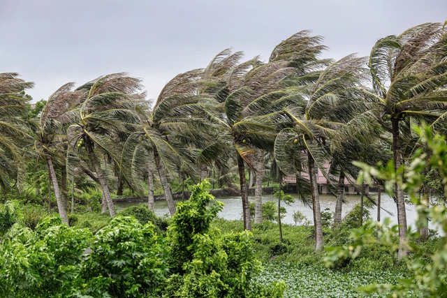
Strong winds caused by storm Wipha lash the coastline of Giao Phuc Commune in Ninh Binh Province, northern Vietnam at noon on July 22, 2025. Photo: Danh Khang / Tuoi Tre
Wipha is forecast to continue moving west-southwest and weaken into a tropical depression over upper Laos by the evening.
The national weather forecast agency noted that strong winds at sea remain dangerous.
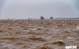
The Gulf of Tonkin, including islands such as Bach Long Vi, Co To, Van Don, Cat Hai, Hon Dau, and Hon Ngu, was experiencing winds of level 6-7 (39-61 kph), with gusts up to level 10 (89-102 kph) near the storm’s center.
Waves are reaching 2-4 meters high, with rough seas.
Storm surge combined with tidal influence has raised sea levels by 0.4 to 0.8 meters in the coastal areas from Ninh Binh to Quang Ninh, heightening the risk of flooding in low-lying coastal and estuary regions.
Inland areas including Hai Phong, Hung Yen, Bac Ninh, Hanoi, Ninh Binh, and Thanh Hoa were experiencing wind gusts of level 6-8 (39-74 kph).
The coastal provinces from Quang Ninh to Nghe An have seen sustained winds of level 6-7 (39-61 kph), with gusts up to level 10 (89-102 kph) near the storm’s core.
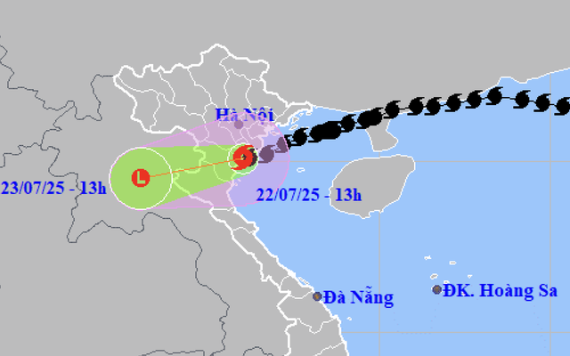
A map shows the projected locations and path of storm Wipha, the third storm to hit the East Vietnam Sea in 2025, as of 1:00 pm on July 22, 2025. Photo: Vietnam’s National Center for Hydro-Meteorological Forecasting
From Tuesday afternoon through Wednesday morning, Thanh Hoa, Nghe An, southern Phu Tho, and Son La are expected to receive 60-120mm of rainfall, with some areas exceeding 200mm.
Other parts of northern Vietnam and Ha Tinh will possibly see 20-40mm of rain, locally reaching over 100mm.
Flash floods, landslides in mountainous areas, and urban flooding in low-lying zones remain major concerns, especially where rainfall may exceed 150mm within a three-hour period.
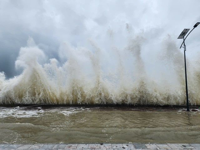
The sea level on Co To Island, a special zone under Quang Ninh Province, northern Vietnam, surpasses four meters due to storm surge and high tides. Photo: Thu Bau
On Co To Island, a special zone under Quang Ninh Province, tides in front of the island’s central square reached a record high of approximately 4.2 meters at around 2:20 pm.
Locals elaborated that the rare phenomenon was caused by southern waves meeting southern winds, according to Le Ngoc Han, secretary of the Co To Party Committee.


The tidal surge began around 12:30 pm, peaking by 2:00 pm with waves crashing 2-3 meters high along the island's seawall.
While the rain has stopped, strong winds continue to batter the island.
Local authorities have deployed patrols along coastal roads and activated emergency plans to protect residents.
“Based on local experience, the water usually recedes within an hour. However, we are closely monitoring the situation and evaluating the risks to the seawall system,” Han said.

Max: 1500 characters
There are no comments yet. Be the first to comment.